• Our new ticketing site is now live! Using either this or the original site (both powered by TrainSplit) helps support the running of the forum with every ticket purchase! Find out more and ask any questions/give us feedback in this thread!

LEJOG (Land's End to John O'Groats Cycle Trip)

Status
Not open for further replies.

TheBigD

Established Member
Joined
19 Nov 2008
Messages
2,043
She looks pretty swish, fair play! Does she handle as well as she looks?

It's a decent bike. It handles well.
Low geared which is good for the climbs but still good for 30+mph on the downhill. Ride position is a bit more relaxed than my Specialized Allez, but not as relaxed as my Giant Revolt.
 
Sponsor Post - registered members do not see these adverts; click here to register, or click here to log in
R

RailUK Forums

Techniquest

Veteran Member
Joined
19 Jun 2005
Messages
21,843
Location
Nowhere Heath
That sounds like an exhausting day! Starting a big ride with a big climb would not be my ideal way to start a day :lol: A mile up a 14%er, yikes! It sounds like it was good overall though.

Edit: Saw your reply after I posted, she sounds like a good machine to be on then!
 

Doctor Fegg

Established Member
Joined
9 Nov 2010
Messages
2,135
Location
Charlbury
It'd been the subject of much debate over dinner. Those of us on garmin have all under read the ascent by varying amounts, mine seems to be the lowest but no one had over 1000 ft, yet all tally with the distance. Those using strava have a much higher ascent, around 3100 ft, but have some slight variation over distance.

The trip notes suggest around 900 meters/3000 ft so strava is correct and garmin way out.

It's probably a question for posting on a cycle forum...
I think I've answered similar questions about eight times on cycle forums...!

The raw stats on your Garmin are either from a barometric altimeter or GPS altimeter. This article explains the difference: https://www.dcrainmaker.com/2010/05/understanding-sport-device-gps.html . Barometric is better but very prone to misconfiguration.

Total climb on a route-planning or recording site, such as Strava, is calculated from a DEM (Digital Elevation Model). This is basically a big grid of the whole world, with a height recorded for each square. In theory, you can work out the climb for a given ride by looking at the height of every square you pass over, recording the difference from the previous square, and totting it all up.

...in theory. In practice, if you try and plot the height of the squares you pass over, it's enormously jagged and suggests there's more climbing than there actually is. So most sites do some sort of smoothing to even this out. The differences in the smoothing algorithm are what causes the differing estimates.

I have spent literally days of my life fine-tuning the algorithm for my site (cycle.travel). I'm pretty confident that it makes a decent fist of it now, certainly better than some sites. But none are perfect and the best advice I can give you is just not to compare values between sites - i.e. compare values from day-to-day on the same site, but not from the same day on different sites.
 

TheBigD

Established Member
Joined
19 Nov 2008
Messages
2,043
@Doctor Fegg

Thanks for that reply. It makes sense now why my garmin was so out. I've also shared the message with the group.
 

TheBigD

Established Member
Joined
19 Nov 2008
Messages
2,043
Tuesday 13th September 2022

LEJOG Day 3 - Launceston to Tiverton.

Another full English to power me through the day. Weather not looking too good today, drizzle with a 14mph headwind from the east.

We left the Trethorne Golf Club in the drizzle and headed wast towards Launceston along country lanes. As we passed through Launceston I noted that it was a shame we never stayed there last night as it looked like an interesting small town to explore. A few miles later we stopped in lay-by for a tea stop and the drizzle had all but stopped, though the steady headwind hadn't.

We continued eastwards towards Okehampton, with a broody, mist covered dartmoor to our south. The scar on the landscape that was Meldon Quarry being clearly visible. A slow run through the centre of Okehampton was necessary due to the traffic. Some of our group sadly having some close passes.

We headed out of Okehampton towards Sampford Courtney, passing by the railway station and over the railway line. A lovely descent along this section saw my first 40+ mph running of the trip! We passed back under the railway line a few miles later and stopped in North Tawton for our lunch.

After lunch the drizzle was back as we headed along some delightful Devon lanes to Lapford, where we passed over the Barnstaple railway line before a cheeky climb out of Lapford. We continued along the rolling hills, through the wonderfully named village Nomansland, before a lovely couple of descents in to Tiverton. Sadly the drizzle had got steadily heavier as we got nearer to Tiverton.

Another good day in the saddle, shame about the weather but I can't change that!

Once I've had a shower etc I intend to explore the old railway line and canal footpaths before a few beers and dinner.

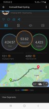
Cycle Stats

Distance - 53.62 miles
Time - 4hr24m57s
Average Speed - 12.1 mph
Ascent - 4052 ft

Tomorrow's ride is 63 miles, from Tiverton to Cheddar.
 
Last edited:

TheBigD

Established Member
Joined
19 Nov 2008
Messages
2,043
Screenshot from Garmin...
 

Attachments

  • Screenshot_20220913-152510_Connect.jpg
    Screenshot_20220913-152510_Connect.jpg
    478.6 KB · Views: 10

TechDan2002

Member
Joined
4 Oct 2019
Messages
216
Location
Penryn
Quite an achievement for the boys at the ages of 15 & 14. Interesting they did it off-road, that must have significantly increased the challenge; is there a map of the route available?

@Huntergreed take a look at the video around 33min 45 seconds and you will see a familiar sight! The commentary refers to the steps we had to climb (but in the reverse direction)

@TheBigD do you have a plan for each day, and a map or a list of what your route is? Good luck with it!
Ned the older one was in my year at school, they both deservedly made top spot in the schools achievement book that year! I don’t have the route map that they took unfortunately.
 

TheBigD

Established Member
Joined
19 Nov 2008
Messages
2,043
unless you are *very* generously proportioned, that calorie burn is overestimated by a factor of at least two!

I've never counted calories in my life!
But I'm 6ft1 and a muscly 101kg.

Edit - others in the group say that garmin records the calories when you are resting, paused as well etc etc.
 
Last edited:

paul1609

Established Member
Joined
28 Jan 2006
Messages
7,992
Location
K
I walked Lejog 3 years ago on the End to End trail 1268 miles took me 101 days including rest days. The conversation with cyclists always revolved about when Id started which was April Fools day. Have it in mind to do a jogle in a few years time probably on a zimmer frame!
 

TheBigD

Established Member
Joined
19 Nov 2008
Messages
2,043
Wednesday 14th September 2022

LEJOG Day 4 - Tiverton to Cheddar

It rained all night but today we finally got lucky with the weather. An 8mph northeasterly wind meant only a negligible headwind today, along with no rain forecast and some sunny spells.

Leaving Tiverton we headed along the Exe valley along the A396, so a flatish start to the day, after around 6.5 miles we turned off and headed through Bampton and onwards to Wiveliscombe, a nice route along a B road with some climbs but nothing major. A few more climbs and descents followed by tea just after Wiveliscombe.

I thought I saw a couple of glimpses of the old formation of the former Taunton to Barnstable line but I'm not 100% sure.

A lovely descent followed, no need to pedal for a couple of miles. We passed over the West Somerset Railway at Norton Fitzwarren before skirting around the North side of Taunton. This part certainly wasn't a highlight of the trip! We then passed over a surprisingly quiet M5, then over the Great Western Main Line, before headed through the appropriately named villages of Ham and North Curry just before lunch.

After lunch we meandered through the country lanes and across the marshes, skirting the railway line several times before we passed through Langport. After a slow and steady climb out of Langport we were along the crest of the hills, the occasional gap in the hedgerows giving us a glimpse of Glastonbury Tor. A lovely descent and we were once more cycling through the marshes before a cheeky climb up and out of Shapwick, followed by another tea stop at Avalon Marshes cafe.

Another short climb and descent followed by a uneventful last few miles in to Cheddar.

I will be walking and exploring Cheddar later this afternoon.

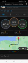
Cycle Stats

Distance 63.28 miles
Time 4hr41m54s
Average Speed 13.5 mph
Ascent 2881 ft.

Tomorrow's cycling will take us the 48 miles from Cheddar to Tintern. Cycling up through Cheddar gorge is one of the highlights of the trip that I'm looking forward to.
 

Attachments

  • Screenshot_20220914-161850_Connect.jpg
    Screenshot_20220914-161850_Connect.jpg
    461 KB · Views: 3

Techniquest

Veteran Member
Joined
19 Jun 2005
Messages
21,843
Location
Nowhere Heath
Another two fantastic days of cycling there! I definitely want to know what cycling Cheddar Gorge is like tomorrow, I have it on my list of roads I want to do but by cripes I'm nervous about doing it. Definitely part of an all-day adventure with some hiking that will be for me!
 

paul1609

Established Member
Joined
28 Jan 2006
Messages
7,992
Location
K
Another two fantastic days of cycling there! I definitely want to know what cycling Cheddar Gorge is like tomorrow, I have it on my list of roads I want to do but by cripes I'm nervous about doing it. Definitely part of an all-day adventure with some hiking that will be for me!
I passed through Cheddar on my End to End trail. It was interesting but very much a tourist honeypot with very high traffic levels. My route took me over the cheddar cliffs to Beacon Batch where I wild camped for the night. Had breakfast in the morning watching the planes taking off from Bristol Airport.
 

Techniquest

Veteran Member
Joined
19 Jun 2005
Messages
21,843
Location
Nowhere Heath
I passed through Cheddar on my End to End trail. It was interesting but very much a tourist honeypot with very high traffic levels. My route took me over the cheddar cliffs to Beacon Batch where I wild camped for the night. Had breakfast in the morning watching the planes taking off from Bristol Airport.

I can imagine it would be very touristy, but then it is a beautiful looking area so it can only be expected. Sounds like you had a beast of a time!

It’s very straightforward.

I think it's all the twists on the relevant road on my map, where they're all packed together, that makes it look much worse than it probably is. The route still remains on my list to do, in combination with other bits in the area, but not likely to be until next year now.
 

TheBigD

Established Member
Joined
19 Nov 2008
Messages
2,043
Thursday 15th September 2022.

LEJOG Day 5 - Cheddar to Tintern.

A few laps of the car park to start the day!

After the warm up it was time to cycle up the gorge. As it was only 0845, there were no tourists (except us!), no traffic, and only the jacobs sheep to keep us company. Whilst it's a straightforward run up the gorge, there is a very short stiff little incline around halfway up. It really is a spectacular ride, though you are through it in less than 15 minutes, and 500 ft higher!

At the top of the gorge we turned left, and headed towards Chew reservoir. A windy tea stop at the 10 mile mark, there followed a few miles of steady climb, a mix of the Avon Valley cycle way and then the Festival way on the outskirts of Bristol's suburbia. A few more miles of cycleways through housing estates we then headed through Ashton Court and then over the Clifton Suspension Bridge. A well deserved bacon butty and hot chocolate was our reward in Clifton Down.

After lunch we headed through the Bristol suburbs, again not a highlight, and on to Pilning, where we caught the first glimpse of the servern bridges.

A few miles along a quiet country lane before we arrived at the Severn Bridge. Thankfully there was very little wind and we had an enjoyable cycle of the Bridge, with spectacular views of the River Servern and the second Severn crossing to our south.

There then followed a pretty dull few miles up to and by Chepstow racecourse before a lovely, pedal free, 25+ mph descent along the Wye Valley to Tintern.

I will be walking the old railway line later, and also have a walk up to the old abbey.

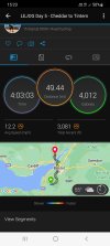
Cycle Stats

Distance - 49.44 miles
Time - 4hr03m03s
Average speed - 12.2 mph
Ascent - 3081 ft

Tomorrow's cycling is 57 miles from Tintern to Worcester.
 

Attachments

  • Screenshot_20220915-152306_Connect.jpg
    Screenshot_20220915-152306_Connect.jpg
    510.6 KB · Views: 3
Last edited:

Techniquest

Veteran Member
Joined
19 Jun 2005
Messages
21,843
Location
Nowhere Heath
Sounds like a good day except for the Bristol bit! I hope you will enjoy the ride through Worcestershire, some of my favourite cycling has happened over there. I must get back there soon to revisit some of it and cover more of the area!
 

TheBigD

Established Member
Joined
19 Nov 2008
Messages
2,043
Friday 16th September 2022

LEJOG Day 6 - Tintern to Worcester

A little lie in this morning with breakfast not being available until 8am, instead of our normal 730am.

The day started with a lovely flatish ride along the wonderful Wye Valley before turning right an heading east towards Coleford and then the forest of Dean. After turning off we had 700ft of climb over about 5 miles before a cracking 35mph descent through the Forest of Dean. As the saying goes, what goes down, must go up. After a brutal granny gear climb for just under a mile we stopped in a picnic area near Speech House for tea.

Another lovely descend followed, then a long granny gear slog up through Cinderford, before another long descent down to the A48 at Westbury-on-Severn.

A short ride along the busy A48 we then turned left and headed along some quiet Gloucestershire lanes for about 10 miles before stopping for lunch at the Hartpury, enjoying a break next to the historical tithe barn and church.

After lunch we had a moderate headwind as we headed through the pleasant country lanes to Upton-on-Severn, with the Malvern Hills to our left, and on to Worcester. The willow lined Gloucestershire/Worcestershire lanes were a lovely ride.

We stopped in Upton for tea, then we "enjoyed" the school run and on to the cycle paths at the edge of Worcester, which take you over a new bridge over a busy roundabout, and another across the Severn before cycling through the centre to our hotel opposite Foregate Street station.

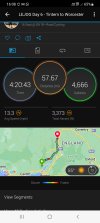
Cycle Stats

Distance 57.67 miles
Time 4hr 20m43s
Average Speed 13.3 mph
Ascent 3373 ft

Tomorrow cycling will take us the 46 miles to Ironbridge.
 

Attachments

  • Screenshot_20220916-160843_Connect.jpg
    Screenshot_20220916-160843_Connect.jpg
    563.3 KB · Views: 5

paul1609

Established Member
Joined
28 Jan 2006
Messages
7,992
Location
K
Sounds good on my End to End walking trail it took me 35 days to get to Ironbridge.
 

Bald Rick

Veteran Member
Joined
28 Sep 2010
Messages
35,965
Worcester to Ironbridge is a lovely ride. Watch out for the descent into Ironbridge, it’s a bit sharp!
 

TheBigD

Established Member
Joined
19 Nov 2008
Messages
2,043
Saturday 17th September 2022

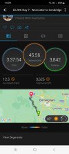
LEJOG Day 7 - Worcester to Ironbridge

Another day of good weather, sunny spells, not too warm, and only a slight headwind.

We left Worcester heading northwest out of the town. Lots of traffic around for the first mile or so. Once out of Worcester we headed along B roads, some of them a bit busy, through the rolling countryside to Bewdley. Part of the ride near Bewdley is particularly pleasant with the Severn on one side and hills above you.

Our first tea stop was in Bewdley, and though we could hear the steam trains on The Severn Valley Railway, we couldn't see them from our spot.

After tea we left Bewdley and headed towards Much Wenlock. A slow and steady climb out of Bewdley up through Button Oak and Button Bridge. Some lovely cycling here through the oak forest before emerging in to a 10mph headwind all the way to the historic Shropshire village of Much Wenlock. Mostly undulating for the next 15 miles along country lanes before we had a few miles on the main road in to Much Wenlock where we had lunch.

After lunch a short climb out of Much Wenlock before a long descent towards Ironbridge. As @Bald Rick posted earlier, there is a sharp descent which takes you down to the Ironbridge, a lumpy, potholed ridden road with a sharp bend, with parked cars, so not the best of roads for a last minute blast! A quick ride over the ironbridge before a short cycle to our hotel.

A shorter day in the saddle today but still a very enjoyable ride.

Another walk planned for this afternoon exploring Ironbridge.

Cycle Stats

Distance 45.56 miles
Time 3hr 37m 54s
Average Speed 12.5mph
Ascent 3625ft

Tomorrow's cycling will see us covering the 54 miles from Ironbridge to Hartford. A route a fair bit flatter then the last 7 days!

 

Attachments

  • Screenshot_20220917-142935_Connect.jpg
    Screenshot_20220917-142935_Connect.jpg
    538.2 KB · Views: 5

Techniquest

Veteran Member
Joined
19 Jun 2005
Messages
21,843
Location
Nowhere Heath
Been a cracking read so far, I can't remember much of anything about Ironbridge, it is on my list for a revisit as I would have last gone there as a rather child. I hope it was a good explore!
 

TheBigD

Established Member
Joined
19 Nov 2008
Messages
2,043
Sunday 18th September 2022

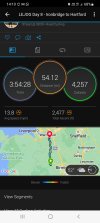
LEJOG Day 8 - Ironbridge to Hartford.

Another day where the weather is on our side. 10mph wind from the northwest, rain not forecast until late afternoon, and sunny spells most of the day.

We set off from Ironbridge up through Coalbrookdale and up the Wrekin. 700ft of climb over 4 miles, the only tough bit being the ride out of Ironbridge. That was pretty much our climbing done for the day.

A lovely descent followed, again through some oak woodlands, and down to Admaston, crossing under the motorway and then over the Wolverhampton to Shrewsbury railway line. More lovely country lanes follwed until our tea stop in Waters Upton.

We then headed north, again along lovely country lanes passing around RAF Ternhill and then along more county lanes and in to Cheshire, until an enforced lunch stop in Audlem (instead of Nantwich) for me after my front brake failed. The rest of the group continued to Nantwich for lunch.

Lunch, well a CoOp meal deal, was had whilst our mechanic arrived and fixed the issue.

Lunch over, and bike fixed, I continued along the A529 to Nantwich. A lovely ride through Nantwich and I was once again heading north, passing over the Crewe to Chester railway line near Worleston, followed by a busy canal (I'm sure someone will know the name) and on through Winsford.

After Winsford I continued through not so quiet lanes until Hartford, and passing over the WCML about a mile from our hotel. About 5 minutes after arriving it started raining so I timed that well!

Not sure what there is to explore I Hartford but I will be taking another walk later to explore.

Cycle Stats

Distance 54.12 miles
Time 3hr 54m 28s
Average Speed 13.8mph
Ascent 2477ft.

Tomorrow's cycling will take us the 71 miles from Hartford to Garstang.
 

Attachments

  • Screenshot_20220918-141057_Connect.jpg
    Screenshot_20220918-141057_Connect.jpg
    596.8 KB · Views: 4
Last edited:

TheBigD

Established Member
Joined
19 Nov 2008
Messages
2,043
Been a cracking read so far, I can't remember much of anything about Ironbridge, it is on my list for a revisit as I would have last gone there as a rather child. I hope it was a good explore!

Nice place. Very picturesque so obviously touristy but well worth a visit.
 

TheBigD

Established Member
Joined
19 Nov 2008
Messages
2,043
I hope your exploring included Ye Olde Robin Hood down last Bedlam. Fabulous pub.

I'm not in to my real ales but some of the group mentioned it this morning.

I had a few pints of San migel with my meal in the hotel after my 4 mile walk around Ironbridge.
 

Techniquest

Veteran Member
Joined
19 Jun 2005
Messages
21,843
Location
Nowhere Heath
Nice place. Very picturesque so obviously touristy but well worth a visit.

Thanks for the recommendation, I'll be having a play about with some planning and studying of maps before long I reckon.

700ft of climbing in 4 miles today was a lot, fair play to you for managing that. I think I'd have caved in with that! Yikes to the mech failure, good thing it's an organised ride with support available! Audlem sounds vaguely familiar, I will have to check my map but I concur with the thought on Nantwich, it's a nice looking place and I need to do a thorough walkabout there some day. I've started there but plenty to see yet.

Winsford's not the most exciting place, I should know as I have family there and they don't think much of it either, but there is a lot of nice cycling opportunities around that part of the world. Hopefully you've found some good walking in Hartford, it's a nice enough walk from Hartford station to Greenbank station and I seem to vaguely remember it's not too bad a place from a ride through there in January.

Good luck for tomorrow!
 

TheBigD

Established Member
Joined
19 Nov 2008
Messages
2,043
Monday 19th September 2022

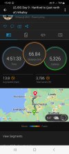
LEJOG Day 9 - Hartford to (just north of) Whalley.

At breakfast we got told the news that due to a very late hotel issue we are now cycling to near Whalley today. Our guides were informed just before 5pm last night and between them and the office had to find alternative accommodation.

Today started with a pretty poor breakfast, the first of the trip. Added the room being very small, and the restaurant service being poor as well, I wouldn't recommend this place, again the first poor showing of the hotels we've stayed at.

Anyway, back to the cycling! Good cycle weather forecast again today. We set off from Hartford and headed north. A bit of pavement riding due to a road closure, then a brief call at the Anderton Boat lift, not very good for photos from the north side, we headed in to the overly Cheshire countryside. Very little traffic today but a fair number of club cyclists out and about. I managed to take a wrong turn and added a couple of miles on to my day! Our route took us over the Manchester Ship Canal. This was on a toll bridge where the charge was shown as 12p! The booth being unmanned we headed over, then crossing over a motorway just before our morning tea break.

After tea our route took by Glazebrook railway station and then on to and through Leigh and Bolton. If it had been a normal working day it would have been a pretty grim ride. As it happens, the roads were deserted, with only the numerous traffic lights to slow us down. We passed by both Daisy Hill and Westhoughton railway stations, and caught a glimpse of Bolton Wanderers football ground. We headed north to Chorley, passing Adlington railway station before crossing the motorway and stopping at The Lock & Quay for lunch.

A pleasant morning's ride with no real climbs, just undulating roads and light traffic. With everything being closed today toilet stops were certainly at a premium!

After a pub lunch and pint, we headed up in to the Lancashire hills. A tough 15 miles took us up from Chorley along some lovely scenic lanes. We climbed steadily, there were some short brutal climbs and twisty descents that you couldn't speed down, but generally the direction of travel was up!

Tea break followed in Mellor followed by a nice 2 mile descent in to Wilpshire, crossing the Blackburn to Hellifield railway line at Ramsgreave and Wilpshire Station. A steady climb once again before a fantastic 3+ mile descent in to Whalley. We entered Whalley via a brutal hairpin bend meaning a quick reduction from 30+mph to below 5mph! On the plus side it gave us a cracking view of Whalley Viaduct.

We then cycled through Whalley and along the Ribble Valley to our accommodation in Hurst Green, a small village a few miles from Whalley.

We ate staying in the small village of Hurst Green. I'm optimistic that there are some lovely walks around here.

Tomorrow's cycling will be a relatively short 36 miles to Kirkby Lonsdale with a fair bit of climbing.

Cycle Stats

Distance 66.84 miles
Time 4hr 51m 33s
Average Speed 13.8mph
Ascent 3786ft.
 

Attachments

  • Screenshot_20220919-154226_Connect.jpg
    Screenshot_20220919-154226_Connect.jpg
    570.5 KB · Views: 4

Sir Felix Pole

Established Member
Joined
21 Oct 2012
Messages
2,212
Location
Wilmslow
Warburton Toll Bridge is free to cyclists, so no regulations contravened! Cycling up the approach ramps can be a pain in heavy traffic, with impatient motorists unable to pass, so you picked the right day for it. Hartford did seem an odd place to stay - Northwich would have been much better with lots of transport interest and good pubs. Good luck with rest of your tour.
 

geoffk

On Moderation
Joined
4 Aug 2010
Messages
3,933
Location
Exeter
Interesting so far. I was hoping your route would not just be A30 and A38 to Bristol, but you used parts of the old A30 including the bit through Okehampton. You probably did well to avoid the Portway (A4), which would have taken you under the Suspension Bridge. The old (1966) Severn Bridge has a cycle track, doesn't it, but not the new one. When I drove over the new bridge a week or so ago the signs said M48 (i.e. the old bridge) was closed, so I don't know how you would have got on.

Why would brake problems on 5A50 (empty sleeper stock Paddington to Reading) have delayed you at Aldermaston?
 
Status
Not open for further replies.

Top