Our new ticketing site is now live! Using either this or the original site (both powered by TrainSplit) helps support the running of the forum with every ticket purchase! Find out more and ask any questions/give us feedback in this thread!
Althugh not Ben Vorlich itself, it seems, as it's hidden behind the Ochils, and its neighbour Stuc only just peeps over them. (The Ben Vorlich in the Arthur's Seat panorama is the other one, near Loch Lomond). My memory of a clear view of Arthur's Seat and at least the tops of the Forth bridges from somewhere in those parts must be from one or more other mountains, most likely Ben Ledi.
Tinto Hill south of Carstairs is visible from Ben Vorlich, although I presume the railway line at its foot is out of the direct line of sight. Tinto looks as if it would be an interesting viewpoint in good weather, as you can see both the Highlands and quite a lot of the Lake District.
Althugh not Ben Vorlich itself, it seems, as it's hidden behind the Ochils, and its neighbour Stuc only just peeps over them. (The Ben Vorlich in the Arthur's Seat panorama is the other one, near Loch Lomond). My memory of a clear view of Arthur's Seat and at least the tops of the Forth bridges from somewhere in those parts must be from one or more other mountains, most likely Ben Ledi.
Tinto Hill south of Carstairs is visible from Ben Vorlich, although I presume the railway line at its foot is out of the direct line of sight. Tinto looks as if it would be an interesting viewpoint in good weather, as you can see both the Highlands and quite a lot of the Lake District.
Is Tinto that very prominent conical mountain you can see as you head south of Glasgow on the M74? I distinctly remember, in 1990 I think, seeing something very prominent, much more so than the rest of the Southern Uplands.
== Doublepost prevention - post automatically merged: ==
Rather annoyingly, I watched a YouTube video not that long ago about that very thing - it was a takedown of a Flat Earther who said it shouldn't be possible at that distance, but I can't remember the title to find it in my watch history.
An incredible distance: roughly equivalent to seeing London from Bournemouth, Tisbury, Westbury, Melksham, Corsham, Cheltenham, or Coventry. (As an aside, I found these distances from this site; they are all about 90 miles from London. I'm amazed that Coventry is so relatively close to London as it seems so much further than the other places mentioned here!)
Obviously I am aware that both the buildings and the hills are considerably bigger in NY than in the UK/London equivalent!
Is Tinto that very prominent conical mountain you can see as you head south of Glasgow on the M74? I distinctly remember, in 1990 I think, seeing something very prominent, much more so than the rest of the Southern Uplands.
Yes....it's situated to the East of the M74 and very close to the West Coast Main Line on the West side of the line between Abington and Carstairs. The nearest former stations would have been Symington and Thankerton (where the Railcam is situated). It is visible from a train on a clear day from Lamington Viaduct most of the way to Motherwell.
Distance-wise that seems plausible, but from the map it looks as if the Campsies might get in the way. Might it be Ben Lomond that's visible from Busby?
Ben Vorlich and its neighbour Stuc a'Chroin are certainly visible from quite a long way south, though. The view from various points on the Carstairs-Edinburgh railway line is often my first or last view of the Highlands.
Maybe there's scope for a discussion (or is there already one somewhere upthread?) on 'longest line of sight from a train in the UK' (other than Snowdon or Snaefell -- the latter of course isn't in the UK anyway).
Ben Lomond is certainly visible from that area. Around East Kilbride its possible to see Goatfell on the Isle of Arran, Tinto near Biggar and the Pentlands to the East.
On a school hillwalking trip in the 1970s we had an amazing view from Ben Ime in the Arrochar Alps encompassing the Atlantic to the North Sea. The Paps of Jura, Ben Nevis, Ailsa Craig and the Firth of Forth were clearly visible, the Forth Bridges could be seen with binoculars.
More recently I was amazed last summer to see the Mountains of North Wales and what appeared to be the Orme Head from the North Pier in Blackpool.
On a school hillwalking trip in the 1970s we had an amazing view from Ben Ime in the Arrochar Alps encompassing the Atlantic to the North Sea. The Paps of Jura, Ben Nevis, Ailsa Craig and the Firth of Forth were clearly visible, the Forth Bridges could be seen with binoculars.
More recently I was amazed last summer to see the Mountains of North Wales and what appeared to be the Orme Head from the North Pier in Blackpool.
On a school hillwalking trip in the 1970s we had an amazing view from Ben Ime in the Arrochar Alps encompassing the Atlantic to the North Sea. The Paps of Jura, Ben Nevis, Ailsa Craig and the Firth of Forth were clearly visible, the Forth Bridges could be seen with binoculars.
More recently I was amazed last summer to see the Mountains of North Wales and what appeared to be the Orme Head from the North Pier in Blackpool.
The Arrochar Alps... scene of one of my few failed summit attempts. Myself and two others were attempting the Cobbler but had to turn back due to extreme winds, this was at Easter 2008. So never experienced the views from there, though we had good luck on Ben Nevis (two occasions out of two) and nearby Ben Lomond.
The "furthest view of Snowdonia" topic is coming up quite a bit here: for me it was I think from Bleaklow at Easter 2000. A somewhat changeable day but it became very clear in the early evening with a very clear view to North Wales. Rather less aesthetically (but still relevant, and another object mentioned up thread) I am fairly sure I saw Drax power station (as well as the slightly nearer Eggborough and Ferrybridge) from a little further north on the Pennine Way on the same trip, somewhere north of Black Hill.
Also, I wonder whether the Cherbourg area is possible from Nine Barrow Down, or from St Catherine's Hill on the IoW, on a really clear day? That is also about 60 miles or so, but admittedly the Cherbourg hills are lower than Burton Down.
OK thanks, I thought this was the case but wasn't sure. Nonetheless, given the elevation of Burton Down, the Cherbourg hills would likely only need to be a little bit higher to be visible. I think they're about 150m, so maybe 200-250m would have done it. Perhaps if you could stand on top of the mast on St Catherine's Hill or the smaller aerial on Nine Barrow Down, you might have luck... I've certainly had a "Welcome to France" text message from the Purbeck coast.
There is, I'm told, line of sight from the top of the Chillerton Down transmitter on the IoW to Alderney. This was how they first got 405 line ITV to the Channel Islands.
And as Alderney is I believe lower and further than the hills behind Cherbourg, I suspect the Cherbourg area would be visible from the top of that transmitter. Perhaps, conversely, with a telescope you could see the red lights of the top of Chillerton Down from the Cherbourg hills? And one of the IoW masts for a time in perhaps the late 90s had two very bright flashing white lights. Perhaps the top most of these could have been sighted from France even without a telescope in exceptionally clear weather?
It's of note that the top of Chillerton Down mast is 400m above sea level which is much higher than any natural summit in south-eastern England.
Going a bit wild topic-wise -- i.e. getting into realms of fiction, set a couple of centuries ago to boot -- but with Cherbourg and high vantage-points coming into the discussion: my mind is irresistibly drawn to a novel by Dennis Wheatley. The first one in his Roger Brook series -- about a Napoleonic "James Bond" figure; I find these patchy, but often entertaining reading. The situation recounted here, has the eponymous hero as a young lad "adrift" in France a few years before the Revolution. He learns by chance, of threatening plans on the part of the French Navy; re which, he finds a way of informing those in Britain in a position to take counter-measures.
The dastardly French scheme: "it was... proposed to build a great watch-tower on the high ground behind [Cherbourg], from which, through a glass, the coast of England would be visible, and, in clear weather, British squadrons entering and leaving Portsmouth roads could be kept under constant observation." I had imagined this whole thing to be old Dennis giving free rein to his imagination for the sake of the story; but the above-quoted info involving the Chillerton Down mast, is rather giving me pause here -- even if a little doubt still felt, re the business of, with late eighteenth-century technology, keeping detailed tabs on the doings of British naval squadrons on the far side.
A few years ago, around 2011, I discovered flightradar24.com and worked out that on a good day (from Hampshire), I could see contrails around the Nord-Pas-De-Calais and also in the Exeter area.
You can I think see the Brecon Beacons from the Marlborough Downs (Tan Hill) on a clear day. I wonder if this is the furthest southeast that you can see really high ground (say 800m+) in the UK? Being able to see 'proper' highland from the chalk downland of southern Britain is interesting.
It's allegedly possible to sight Kinder Scout from Worcestershire Beacon on the Malvern Hills, according to the direction finder on the latter, though I have the feeling that was debunked somewhere. In the other direction I have the feeling that Uffington White Horse Hill is possible, i.e you can see beyond the Cotswolds, though I have never seen one from the other (visited Worc Beacon just the once and Uffington about three times).
On the subject of FlightRadar24, on really clear winter mornings from Altrincham (just as the sun’s rising) I have seen contrails of eastbound aircraft high over the North Sea (quite some way east of Skegness). And in the same wintry conditions with a good clear view to the east, from south Derbyshire I have seen contrails of Scandinavia-bound aircraft from Heathrow. The app showed the location of these aircraft as east of Ipswich.
I think you might be right about the Brecon Beacons/Marlborough Downs being the furthest view seen to the south-east. Pen y Fan is the highest point in southern Britain so seems best-placed for a sweeping view east/south-east.
On the subject of Kinder Scout being visible from the Malvern Hills, it’s always struck me that this is a line of sight that should be possible. But looking at it in detail on the map, the ridge of Shining Tor (to the south of Kinder Scout) looks to be blocking any view due south from Kinder Scout. However, Shining Tor is visible from the Malvern Hills.
Kinder Scout fascinates me because I dont think there’s anywhere else that has a view that spans the Lincolnshire Wolds and east Leicestershire in one direction, and then Snowdon in the other direction.
On the subject of FlightRadar24, on really clear winter mornings from Altrincham (just as the sun’s rising) I have seen contrails of eastbound aircraft high over the North Sea (quite some way east of Skegness).
On the subject of Kinder Scout being visible from the Malvern Hills, it’s always struck me that this is a line of sight that should be possible. But looking at it in detail on the map, the ridge of Shining Tor (to the south of Kinder Scout) looks to be blocking any view due south from Kinder Scout. However, Shining Tor is visible from the Malvern Hills.
It "seems" a very long way, so it's quite amazing that even Shining Tor is visible.
Incidentally, if (Uffington) White Horse Hill is also visible from Worcestershire Beacon, is it perhaps the only point from which northern England and 'true' southern England are visible simultaneously? Cheshire is fairly unambiguously reckoned to be in the 'north', and while the Midlands-South boundary is rather poorly defined, I personally would consider a line of latitude going though Oxford as the northernmost limit of the true 'South' though opinions differ on this.
== Doublepost prevention - post automatically merged: ==
Going a bit wild topic-wise -- i.e. getting into realms of fiction, set a couple of centuries ago to boot -- but with Cherbourg and high vantage-points coming into the discussion: my mind is irresistibly drawn to a novel by Dennis Wheatley. The first one in his Roger Brook series -- about a Napoleonic "James Bond" figure; I find these patchy, but often entertaining reading. The situation recounted here, has the eponymous hero as a young lad "adrift" in France a few years before the Revolution. He learns by chance, of threatening plans on the part of the French Navy; re which, he finds a way of informing those in Britain in a position to take counter-measures.
The dastardly French scheme: "it was... proposed to build a great watch-tower on the high ground behind [Cherbourg], from which, through a glass, the coast of England would be visible, and, in clear weather, British squadrons entering and leaving Portsmouth roads could be kept under constant observation." I had imagined this whole thing to be old Dennis giving free rein to his imagination for the sake of the story; but the above-quoted info involving the Chillerton Down mast, is rather giving me pause here -- even if a little doubt still felt, re the business of, with late eighteenth-century technology, keeping detailed tabs on the doings of British naval squadrons on the far side.
Going back on topic I've found this site which allows you to generate a panorama from any point at any altitude.
Using it, if you set the altitude to 250m above Cherbourg, the hills of the Isle of Wight can be seen, prominent enough to be drawn on the generated panorama. Nine Barrow Down is also claimed though its outline can't be seen on the generated panorama. Remember that several points in the South Downs exceed 250m, so in theory, if the Cherbourg hills were of comparable elevation to the higher South Downs, then Normandy-UK views (and v.v.) would be possible.
In the other direction, the Isle of Wight hills would have to be of considerable elevation to see the Cherbourg hills 'as they are'; elevations not seen in southern England outside the southwest. A French point is claimed at an elevation of 300m at the site of St Catherine's Hill, but not clearly visible; while at 350m the outlines of the Cherbourg hills are discernible.
Also on the France-UK intervisibility topic, it does indeed seem that Willingdon Hill is the furthest west you can see France from the UK, with one hill just about visible 100km away. Slightly further west at Windover Hill it's not possible (in fact Willingdon Hill blocks the view in that direction).
EDIT: and as a further piece of fun with the above site, I tried setting the elevation above Black Down, West Sussex (county HP and a hill I'm very familiar with) to first that of Scafell Pike (978m), then that of Ben Nevis (1343m), then 2900m (comparable to Mount Olympus or Zugspitze) and finally 8848m (elevation of Everest).
Somewhat disappointingly, you couldn't see out of central southern or southeast England at the Scafell Pike elevation: I was expecting to be able to see at least the Mendips or Cotswolds. None seem possible. Furthest points were basically on the rim of the chalk hills in west Wiltshire or west Berkshire, with 100km typically the limit; Black Down, Dorset (site of the Hardy Monument) was furthest at around 140km.
Raising the elevation to 1343m you do significantly better with south Wales visible (specifically Blorenge, outside Abergavenny) and Mont Lambert (France, south of Boulogne) as well as Beacon Batch (Mendips), the hills above Bath, and Birdlip Hill (Cotswolds). Still no Dartmoor or Exmoor, though. Furthest point appears to be somewhere in the Brecon Beacons National Park. Raising the elevation from that of Scafell Pike to that of Ben Nevis thus makes a big difference in terms of seeing 'out of region'. And a theoretical 'Ben Nevis of Sussex' could thus be sighted from a huge distance, from France to Wales.
At 2900m you could see considerably further, with visible points including Dartmoor, considerable parts of the mountains of South Wales, the Wrekin, and various points in northeastern France and Normandy - showing how far away mountains of the Olympus or Zugspitze height can be sighted from in ideal conditions. Limit is generally 200km though there is one point in France shown at close to 250km.
At 8848m views extend a huge distance, with Bleaklow visible and some points beyond that too, as well as Vlissingen, Belgium. Hull is also included in the panorama. Limit seems to be around 300km. Can't see Snowdon or any of the other Snowdonian mountains labelled in the panorama - but perhaps that is due to lack of space. Thus the claim by a pilot that they could see Manchester when flying across southeastern England is likely true.
It would be easy to test that exactly by setting the elevation to that of an airliner at cruising altitude over the coast - or indeed, above anywhere to see what would be visible?
Interesting - particularly as the eastern horizon at Altrincham isn't as low as it could be, due to the Peak District.
Incidentally, if (Uffington) White Horse Hill is also visible from Worcestershire Beacon, is it perhaps the only point from which northern England and 'true' southern England are visible simultaneously? Cheshire is fairly unambiguously reckoned to be in the 'north', and while the Midlands-South boundary is rather poorly defined, I personally would consider a line of latitude going though Oxford as the northernmost limit of the true 'South' though opinions differ on this.
Early mornings in winter from Altrincham can produce some great skies to the east. The hills of east Cheshire and Derbyshire provide a brilliant contrast between land and sky, and just before the sun comes up over the hills there can be some really long distance contrails spotted in the clear dawn sky. Altrincham town centre has some great vantage points for taking in the views east. Moss Lane bridge next to the railway station is a great spot for a good view of the dawn sky to the east. During the spring and summer the same spot also gives a dramatic view of Kinder Scout, when in certain conditions the hills can look really close and the slopes of Kinder Scout look very clear. (Part of Kinder Scout straddles the ‘S’ postcode and it always amazes me that the outer edges of the Sheffield postcode area can be seen from Greater Manchester, Cheshire, and beyond).
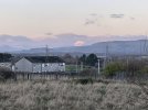
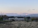
While trying to investigate, I came across https://www.udeuschle.de/panoramas/makepanoramas_en.htm, which appears to let you generate a panorama from anywhere. Generating one from the approximate location of Foxbar gives this, from which it looks as if your large snowy mountain is likely to be Ben Lomond. (No doubt there are people here who could have told you that just by looking at it).
I was confused for a while by the small but distinctive hill immediately over the gable end of the houses, which looks rather like the view of Dumgoyne that you get from further east (e.g. from the WCML approaching Glasgow); I think in fact it's probably here.
An unexpected line of sight that I caught on Saturday was the incredible view of the control tower at Manchester Airport seen from an elevated part of Stoke-on-Trent (between Tunstall and Talke). The lovely sunny weather really made the tower stand out.
Whilst this won't top any records, during the night I'm sure I was able to still see plane lights in the sky when the plane was over South Ayrshire, from Newton train station in Cambuslang. About 40 miles away. It is also possible during the night to see plane lights after they take off from Edinburgh Airport, around the Livingston/Uphall area.
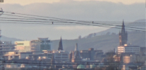
Also from Newton train station footbridge I was able to get a hazy photo (with a 60x camcorder) of what looks like the Scottish Power office on St Vincent Street in Glasgow City Centre alongside what looks like a large church spire to the far right of it, can anyone identify what building that is?
Again these are by no means the longest as the city centre is only a mere 6 miles away.
It's allegedly possible to sight Kinder Scout from Worcestershire Beacon on the Malvern Hills, according to the direction finder on the latter, though I have the feeling that was debunked somewhere.
These direction finders on viewing points aren't always a realistic guide to what can be seen. On Therfield Heath near Royston one points out the Great Pyramid in Egypt!
Whilst this won't top any records, during the night I'm sure I was able to still see plane lights in the sky when the plane was over South Ayrshire, from Newton train station in Cambuslang. About 40 miles away. It is also possible during the night to see plane lights after they take off from Edinburgh Airport, around the Livingston/Uphall area.
Also from Newton train station footbridge I was able to get a hazy photo (with a 60x camcorder) of what looks like the Scottish Power office on St Vincent Street in Glasgow City Centre alongside what looks like a large church spire to the far right of it, can anyone identify what building that is?
Again these are by no means the longest as the city centre is only a mere 6 miles away.
Whilst this won't top any records, during the night I'm sure I was able to still see plane lights in the sky when the plane was over South Ayrshire, from Newton train station in Cambuslang. About 40 miles away. It is also possible during the night to see plane lights after they take off from Edinburgh Airport, around the Livingston/Uphall area.
Also from Newton train station footbridge I was able to get a hazy photo (with a 60x camcorder) of what looks like the Scottish Power office on St Vincent Street in Glasgow City Centre alongside what looks like a large church spire to the far right of it, can anyone identify what building that is?
Again these are by no means the longest as the city centre is only a mere 6 miles away.
Renfield St Stephen's in Bath Street? As regards planes, they can be seen from spectacularly log distances. Thanks to FlightRadar I have identified aircraft flying out into the Atlantic over Oban from Uddingston and passing into England south of Jedburgh, etc; from Lanark.
These direction finders on viewing points aren't always a realistic guide to what can be seen. On Therfield Heath near Royston one points out the Great Pyramid in Egypt!
If I remember right, though, that one only shows what can actually be seen. Typically, if a hill is shown, it's visible whereas if a town is shown it isn't.
Some very good visibility conditions in the last week from Mow Cop on the Cheshire/Staffordshire border. I think the cluster seen in the centre of this photo (to the southwest) is Rodney’s Pillar in Powys.
While up on Crag Height, about 302 metres a.s.l.,above the villages of Beckside and Kirkby in Furness in south Cumbria, recently I noticed that looking NNW across the Duddon estuary and through the dip between Black Combe and White Combe, I could make out what I believed was the Isle of Man. Looking in the opposite direction I could see Blackpool Tower.
Whilst this won't top any records, during the night I'm sure I was able to still see plane lights in the sky when the plane was over South Ayrshire, from Newton train station in Cambuslang. About 40 miles away. It is also possible during the night to see plane lights after they take off from Edinburgh Airport, around the Livingston/Uphall area.
Also from Newton train station footbridge I was able to get a hazy photo (with a 60x camcorder) of what looks like the Scottish Power office on St Vincent Street in Glasgow City Centre alongside what looks like a large church spire to the far right of it, can anyone identify what building that is?
Again these are by no means the longest as the city centre is only a mere 6 miles away.
There is a few buildings in Glasgow that are visable quite far away. The new hospital near Govan is one. When you travel along the M8 at Newhouse, you can see many of the high buildings in Glasgow.
There is a gap in the hills on the A737 coming out of Dalry, you go up an incline and in the distance I believe you can see the runway approach lights of Glasgow Airport as the road does get pretty high up.
Some very good visibility conditions in the last week from Mow Cop on the Cheshire/Staffordshire border. I think the cluster seen in the centre of this photo (to the southwest) is Rodney’s Pillar in Powys.
Yes, that was the name, on the tip of my tongue yesterday. Heard the name Breidden Hills, and Moel y Golfa for the highest(?), but not the name Rodney's Pillar.
At certain times, Plynlimon in the Cambrian Mountains is visible from Mow Cop. The possible panorama from the top of Plynlimon is quite wide-ranging. I am always amazed by what possible extreme vistas can be seen from one spot. With Plynlimon, it is possible in the right conditions to see south-east Ireland in one direction and Derbyshire/Staffordshire/Worcestershire in another direction.
Similar too with the top of Snowdon - being able to see south-east Ireland in one direction and North Yorkshire in another direction.
I climbed the Campsies on the outskirts of Glasgow yesterday, I was impressed by how far I could see, however the haze over Glasgow obstructed things a bit.
I could immediately make out Glasgow University and Glasgow Tower behind it, as well as the high flats at Castlemilk and other tall buildings in the City Centre. To my centre-left I could also see the water tower at Motherwell and the conurbation of Coatbridge, Whifflet and Motherwell, and of course Tinto hill. To my right I could also see Gleniffer Braes, some flats near Paisley and planes clearly climbing out of the airport.
Image is a Panorama taken from roughly halfway up the Campsies.
We are aware of an issue with emails from the Forum to Microsoft-based email accounts (hotmail/outlook/live.com email addresses). This is being looked into currently, thanks for your patience meanwhile.