Skelmersdale was designated a new town in 1961. The first residents located in 1964. Skelmersdale station was on the the Ormskirk to St Helens line which completely closed down in 1963.
The station was located in what is now referred to as Old Skem, on the west side of the town.
The original station site in Old Skem would be useless today.
I'm losing count of the number of times I've said this. The spur from the Kirkby-Wigan line would pass under the M58 by the bridge where Whiteledge Road now goes under the motorway, about 1km east of J4. My own belief is that Whiteledge Road could remain open, though others have suggested otherwise. Some other bridges would probably be required to the north of the M58.
The M58 bridge looks like it was built with provision for Whiteledge Road to be dualled, so it probably wouldn’t be necessary to close it, but it wouldn’t be the worst thing in the world if it was sacrificed for the sake of a railway.
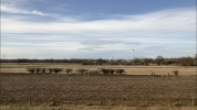
I make it that the spur would be built from approximately this location, or at the very least visible in the scene from this location, taken from a video I took from a train between Kirkby and Orrell. Does anyone know the location of the wind turbine, as this may help to work out the precise location.
What sort of curve radius are we likely to see built? The ones at Burscough and Heald Green are ~400m and the one at Farington is a bit less. In length, the spur would be less than half a mile more than the one to Manchester Airport. The biggest obstacle is that it could potentially require up to 6.5 miles of redoubling between Fazakerley and Rainford to create the required capacity for a service.