• Our new ticketing site is now live! Using either this or the original site (both powered by TrainSplit) helps support the running of the forum with every ticket purchase! Find out more and ask any questions/give us feedback in this thread!

St Albans City to St Albans Abbey

Status
Not open for further replies.

FQ

Established Member
Associate Staff
Quizmaster
Joined
4 Oct 2013
Messages
6,645
Location
-
Hi all,

Could someone help me with the following questions please?

1. What is easier to travel between St Albans City and St Albans Abbey, walk or bus?
2. If answer to 1 is walk then what walking routes do people suggest between the two places?
3. If answer to 1 is bus then what times do buses leave St Albans City and arrive at St Albans Abbey?

This is for Friday the 27th of November.

Cheers!
 
Sponsor Post - registered members do not see these adverts; click here to register, or click here to log in
R

RailUK Forums

Adam0984

Established Member
Joined
18 Feb 2014
Messages
1,213
Definitely walk able. I did it and took a slight detour to the Tesco Metro in town as I did it in summer and needed a drink. You walk up into the town and take a left and head down the hill Google says a 24 mins walk
 

James Wake

Member
Joined
30 Aug 2013
Messages
962
John Webb who volunteers at St Albans South signal box gave a 20 minute walking route on a previous thread:

The 'obvious' route to St Albans Abbey station from the City station goes down and up and down hill and is effectively two sides of a triangle. You would be pushing it to try and cover in 20 mins. There is a slightly shorter and less 'up and down' walk which takes you past the old London Road station linked to by CarltonA.
Come out of St A City station via the platform 4 exit (you will have come off the train from Bedford on platform 1 or 3, so use the footbridge.)
Bear left into the carpark and Ridgmont Road and carry along the latter until you come to a line of bollards. (St A South Sigbox will be on your left at this point.)
Turn through the bollards and carry on down Ridgmont Road.
Bear left at the end into Grosvenor Road and walk down it - at the end by a roundabout, cross straight over London Road - the old station is now on your left. Bear right into Orient Close and follow through to the resumption of the "Alban Way" (the old Hatfield/St Albans railway trackbed.
Pass under a former railway bridge taking Cottonmill Lane overhead and cross the railway line in front of you at the foot crossing.
Bear right into Griffiths Way, with a Sainsbury's on your right, walk to the end of that road and bear right at the roundabout (St Stephen's Hill) and the station is a short distance further on, on your right.

There is no need to climb up the hill into the town and then back down again.
 

DarloRich

Veteran Member
Joined
12 Oct 2010
Messages
32,939
Location
Fenny Stratford
There is a bus but the walk is pleasant enough although up hill from Abbey to the City centre. Call it half an hour for a normal person.

From city to abbey:

Come out of station onto Victoria Street. Walk straight down that street to city centre. Turn left at Chequer street then straight down Holywell Hill to the Abbey station.

If you have time have a wander round the Abbey and the roman remians
 
Last edited:

30907

Veteran Member
Joined
30 Sep 2012
Messages
21,981
Location
Airedale
Years since i last did it, locals on the forum might add some detail.

Googlemaps confirms what i recalled
(1) there's not much to be gained by using bus, but the 724 runs direct.
(2) you might as well walk straight up to the city centre and turn left, just over a mile.

Darlorich was quicker!
 

James Wake

Member
Joined
30 Aug 2013
Messages
962
Although if you needed to get some lunch, when you get to the top of the Victoria Street, if you turn right like DarloRich suggested you would be headed into town, there is a Tesco Metro, Costa, lots of places on St Peters Street. At the top of Victoria Street, to go down Holywell Hill towards St Albans Abbey, you must turn left.
 
Last edited:

AM9

Veteran Member
Joined
13 May 2014
Messages
16,061
Location
St Albans
John Webb who volunteers at St Albans South signal box gave a 20 minute walking route on a previous thread:

The 'obvious' route to St Albans Abbey station from the City station goes down and up and down hill and is effectively two sides of a triangle. You would be pushing it to try and cover in 20 mins. There is a slightly shorter and less 'up and down' walk which takes you past the old London Road station linked to by CarltonA.
Come out of St A City station via the platform 4 exit (you will have come off the train from Bedford on platform 1 or 3, so use the footbridge.)
Bear left into the carpark and Ridgmont Road and carry along the latter until you come to a line of bollards. (St A South Sigbox will be on your left at this point.)
Turn through the bollards and carry on down Ridgmont Road.
Bear left at the end into Grosvenor Road and walk down it - at the end by a roundabout, cross straight over London Road - the old station is now on your left. Bear right into Orient Close and follow through to the resumption of the "Alban Way" (the old Hatfield/St Albans railway trackbed.
Pass under a former railway bridge taking Cottonmill Lane overhead and cross the railway line in front of you at the foot crossing.
Bear right into Griffiths Way, with a Sainsbury's on your right, walk to the end of that road and bear right at the roundabout (St Stephen's Hill) and the station is a short distance further on, on your right.

There is no need to climb up the hill into the town and then back down again.

Since the old open car park has been developed, there is a better way to access the Alban Way:
Leave via the main station exit (Platform 1), turn right and walk past the taxi rank and follow the footpath under the Victoria St bridge. The footpath ends at a crossing over the road that feeds the multi-storey car prak and a new apartment development, (not yet shown on Google maps). Walk straight through this area when you will get to some steps down to a tree-covered footpath. This is the Alban Way. Turn right and walk down the hill, passing under a high viaduct carrying the MML then pass under London Road bridge to arrive at the old London Road station, - well preserved as a day nursery. Then follow directions given by Jame above.
When you pass Sainsburys car park/filling station, turn right as if driving into Sainsburys and on your left is the Abbey View office complex. Turn left into its car park and continue walking until you get to some steps that lead you down onto St Stephens Hill. Then turn right where the entrance to the Abbey station is a bit nearer.
 

FQ

Established Member
Associate Staff
Quizmaster
Joined
4 Oct 2013
Messages
6,645
Location
-
Thanks for the help guys! I will write them all out them choose which one to go for on the day. Just one final question: is any part of them on busy roads?
 

Kristofferson

Member
Joined
23 Nov 2012
Messages
1,132
Depends what you mean by busy. There's no big major roads, lots of crossings, but the 30mph roads around/through town are never quiet.
 

FQ

Established Member
Associate Staff
Quizmaster
Joined
4 Oct 2013
Messages
6,645
Location
-
Thanks, that's what I meant - major roads.
 

John Webb

Established Member
Joined
5 Jun 2010
Messages
3,781
Location
St Albans
Thanks to James Wake for saving me printing out my previous message.

I note AM9's comments about the other way to access the Alban Way, but would say my suggested route is shorter in time and distance, but not by a large amount (5mins and quarter of a mile?). My route does need a crossing of the busy London Road, but there is a light-controlled pedestrian crossing very close to the junction with London Road and Grosvenor Road which can be used.

I regret the signal box will not be open when you pass, however!
 

AM9

Veteran Member
Joined
13 May 2014
Messages
16,061
Location
St Albans
Thanks to James Wake for saving me printing out my previous message.

I note AM9's comments about the other way to access the Alban Way, but would say my suggested route is shorter in time and distance, but not by a large amount (5mins and quarter of a mile?). My route does need a crossing of the busy London Road, but there is a light-controlled pedestrian crossing very close to the junction with London Road and Grosvenor Road which can be used.

I regret the signal box will not be open when you pass, however!

Just to add, the way that I suggested doesn't call for any roads to be crossed except the entrance to Sainsbuyrs which has and island anyway.
 

FQ

Established Member
Associate Staff
Quizmaster
Joined
4 Oct 2013
Messages
6,645
Location
-
AM9, with your post, do I need to cross the road next to the apartment buildings and multistory carpark in order to get to the Alban way? If not then which way do I go to go 'straight through' the area and do I need to head down the Alban way? And where do I turn right to walk down the hill?

Thanks for your help!
 

Bald Rick

Veteran Member
Joined
28 Sep 2010
Messages
35,941
Going the easiest route to find, ie Victoria Street / Holwell hill is longer, but far better for pubs.
 

AM9

Veteran Member
Joined
13 May 2014
Messages
16,061
Location
St Albans
AM9, with your post, do I need to cross the road next to the apartment buildings and multistory carpark in order to get to the Alban way? If not then which way do I go to go 'straight through' the area and do I need to head down the Alban way? And where do I turn right to walk down the hill?

Thanks for your help!

Sorry, I've been thinking about my statement on road crossing and it is not quite right. The path from the station runs along the east side of the MML tracks, and there is a raised table crossing over the road. You need to cross here and continue on the other side of the road, walking down past parking places. It is very quiet along there with occasional vehicles visiting the dwellings there. At the end of the development (it is built on a falling slope) is a set of steps and an accessible slope to the Alban Way which here runs in a tree-lined shallow cutting. When you reach the bottom of the steps/slope, turn right (i.e., head south-west).
The current aerial view on Google Maps shows the car park and the road winding its way down the opposite side of it to the railway. The Alban Way runs in the double row of trees aligned in a NE-SW direction.​
 

FQ

Established Member
Associate Staff
Quizmaster
Joined
4 Oct 2013
Messages
6,645
Location
-
Thank you!
 

FQ

Established Member
Associate Staff
Quizmaster
Joined
4 Oct 2013
Messages
6,645
Location
-
Good point!
 

AM9

Veteran Member
Joined
13 May 2014
Messages
16,061
Location
St Albans
Last week, I popped out and took a few phone snaps of the key points on the walking route. As I don't have a flikr or similar online image account, I would be grateful if anybody could confirm whether and how I can post pictures from a local drive, either in a thread or in a private e-mail.
 

FQ

Established Member
Associate Staff
Quizmaster
Joined
4 Oct 2013
Messages
6,645
Location
-
When posting, you need to go to 'Go Advanced'. After clicking on that button you have many more options. One of these is a paper clip. Click on that and a separate (small) window will open. Then you need to click on 'choose file'. After doing this you will get to select a photo to upload. Once you have chosen (by double clicking), that page will disappear leaving you with the one that says choose file. But instead of clicking 'Choose File' this time you need to click 'Upload' and give it a few seconds to work. Then you can upload another and another. Then, after posting delete that window and at the bottom of your post will be an attachment like below (please note, the photo below has nothing to do with this thread).
 

Attachments

  • IMG_7571.jpg
    IMG_7571.jpg
    163.6 KB · Views: 8

AM9

Veteran Member
Joined
13 May 2014
Messages
16,061
Location
St Albans
When posting, you need to go to 'Go Advanced'. After clicking on that button you have many more options. One of these is a paper clip. Click on that and a separate (small) window will open. Then you need to click on 'choose file'. After doing this you will get to select a photo to upload. Once you have chosen (by double clicking), that page will disappear leaving you with the one that says choose file. But instead of clicking 'Choose File' this time you need to click 'Upload' and give it a few seconds to work. Then you can upload another and another. Then, after posting delete that window and at the bottom of your post will be an attachment like below (please note, the photo below has nothing to do with this thread).

OK. Couldn't find 'Go Advanced' but I do get the paper clip.
So here goes:

1) After you have passed the taxi rank the path comes to a road crossing

2) Cross the road and continue in the same direction following signs for The Alban Way

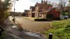
3) Walk down through the development keeping to the footpath/service road...

4) to the fence at the bottom

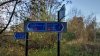
5) Turn right onto the St Albans Green Ring (which is the Alban Way)

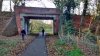
6) After about 200m, you will pass under the MML skew bridge and then London Road bridge

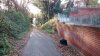
7) Here on the right is the Original London Road station building complete with platform, preserved as a day nursery

8) Continue through the houses and onto the Alban Way for another 700-800m until you pass under Cottonmill Lane overbridge

9) Just pass the bridge, there is a choice of routes. If you go the signed route to the Abbey staion (bear right) it will take you along Prosepect Road to St Stephens Hill (turn left) then turn left again into the station yard. If you bear left, the footpath crosses the Abbey line then turn right and walk straight past Sainsburys to the Abbey View office complex, where you can either stay on the same road or pass through it to St Stephens Hill and turn right and then right again into the station entrance.

I hope that this helps. The walk is normally pleasant and is quite safe, it also may have a history interest as there are boards giving information about the original GNR St Albans to Hatfield railway at various places.
Please ask if you have any more questions.

 

Attachments

  • 1.jpg.jpg
    1.jpg.jpg
    163 KB · Views: 19
  • 2.jpg.jpg
    2.jpg.jpg
    177.6 KB · Views: 16
  • 3.jpg.jpg
    3.jpg.jpg
    125.6 KB · Views: 17
  • 4.jpg.jpg
    4.jpg.jpg
    151.1 KB · Views: 15
  • 5.jpg.jpg
    5.jpg.jpg
    190.9 KB · Views: 16
  • 6.jpg.jpg
    6.jpg.jpg
    140.8 KB · Views: 18
  • 7.jpg.jpg
    7.jpg.jpg
    163.4 KB · Views: 16
  • 8.jpg.jpg
    8.jpg.jpg
    188.1 KB · Views: 17
  • 9.jpg.jpg
    9.jpg.jpg
    213.4 KB · Views: 15

FQ

Established Member
Associate Staff
Quizmaster
Joined
4 Oct 2013
Messages
6,645
Location
-
Thanks so much for your help AM9! I owe you one!
 

John Webb

Established Member
Joined
5 Jun 2010
Messages
3,781
Location
St Albans
If you take AM9's route, couple of things to note:
Opposite point 1, the road crossing, you will see St Albans South signal box on the opposite side of the railway line.
At point 6, the MML skew bridge, note the join line between the two halves. The west side was built for the original 1868 extension, the east side was built 1892/3 for the extension of the goods lines south from St Albans in 1894.
 

FQ

Established Member
Associate Staff
Quizmaster
Joined
4 Oct 2013
Messages
6,645
Location
-
Thanks. I will look out for them.
 

FQ

Established Member
Associate Staff
Quizmaster
Joined
4 Oct 2013
Messages
6,645
Location
-
Thanks to AM9 and James Wake and of course everyone else who helped. I managed to get there with good time to spare until my train.
 
Status
Not open for further replies.

Top