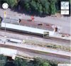
Can anyone explain, or point me to a source/map showing the original track layout of what is today the Chiltern Main Line towards the London end, i.e. was it quad-tracked, and where ?
Trying to track the route today I make the following observations (from regularly using the line and viewing Google earth) [apologies for length of this, it wasnt supposed to go on and on...]
1) From Denham London bound it would appear that it was always twin track, as dictated by bridge and embankment widths.
2) At West Ruislip it was quadtracked, of which 3 remain, and the trackbed for the 4th having been built over by the southern platform, with the trackbed then visible as empty space running towards Marylebone and an unused bridge span over what is now the Piccadilly/Metropolitan lines to Uxbridge.
3) I think, that either next to or using part of, the Central Line Ruislip depot, the quadtracking continued, at least until the Bridge over West End Road. But its hard to tell if this would have been wide enough.
4) It looks like the bridge on the London side of South Ruislip could have been wider, and 4 tracks could have continued to run through here.
5) After this we have the waste transfer area, no shortage of land, easy to have had quad tracks running through this area, but at the Eastern end of it, there are two single track width bridges taking the line over a road, and the embankment continuing on looks only twin track width.
6) Similarly the bridge over the A312 is only twin width.
7) From Northolt Park, there are newish buildings alongside the line, but it looks like there is spare space in other parts, and a couple of overbridges with spans over empty space thus looking like this section had more tracks.
8) There is then the tunnel under the Piccadilly line, the portal of which is only big enough for twin track.
9) There is ample space running up to South Harrow station, and that stations footbridge clearly spans a quad track, coming down on the non lines side of the existing platforms (built over the outer two lines ?). The next bridge, under Greenford Rd is also massively wider with unused spans, as is the bridge beyond.
10) At Sudbury & Harrow, the track corridor is very wide, and possibly the existing station has been built over the original middle pair of lines ?
11) The embankment after this, and a couple of over bridges roads and the girder one over the WCML look narrow, only ever twin track ?
12) The line after this significantly diverges, and the under bridge of the A4080 again looks far wider and has unused track corridors under it. You then run into Wembley which I know was four track.
13) After the new train depot, it looks wide enough for four tracks (1-2 of which used as sidings now), but has Great Central Way road running alongside (road over former trackbed ?)
14) Joins the Aylesbury Line, with the Met/Jubilee lines to the North. From here I can really only see twin track, not least due to the old (brick, Victorian) buildings forming warhousing/railway buildings and so on acting as flanks. Unless previously there was more line sharing with the Met lines ?
15) A bit further on, all the lines cross Park Avenue, which has a 2-4 track width set of bridges to the North (of all the 6 Chiltern/Met/Jubilee lines) which are now isolated, with newish buildings on either side implying at one point this railway corridor could have been 8-10 tracks wide in total? Immediately after is Willesden Green station which Chiltern miss by diving down the side of there is no indication these lines could have ever had platforms.
16) At Kilburn, the Chiltern lines again dive south, crossing the roads on their own bridges. Again, unless the Met/Jubilee lines were used, there seems no scope for a quad track route.
17) At Finchley Road, the 2 Chiltern lines move south, and into the tunnel(s) that ultimately lead to Marylebone. I always see the unused (double?) portal on the south side of the line as you enter, but when you pop out to cross the NLL there is no corresponding tunnel portal there. I understand from other posts this tunnel was never finished/used?
18) At the south (Marylebone) end of the tunnel, Google maps shows twin tracks in it (which is what you see when passing through) but with points, a connection to the Met/Jubilee lines, and a third & 4th track heading for Marylebone. So was/is it a twin tunnel, opening out again to quad track for the station ?
19) The station entrance has a number of unused bridges, and I know the former large goods yard to the West resulted in numerous extra lines (now built over by the council estate and the large Bank building (both of which would seem to preclude further re-expansion of Maylebone). Including some new flats now sitting between the Met/Jubilee lines which presumably was the milk bottling plant.
20) A 1946 signalling map of Marylebone below shows up and slow down and fasts, implying 4 routes heading out through tunnels under Lords? There are still some old rails running parallel (on the West side) to the existing tracks into the tunnel, I assumed these were part of the goods yard, or headshunts, and although it gets dark at the tunnel entrance and so difficult to see, there doesnt appear any relic of a parallel tunnel these could have gone into ?
So, did the quadtracking just run in station areas or how extensive was it?, and when did the changes to the current layout take place? (60s/70s post GCR closure or in the BR total route modernisation in the 80s?).
From the join with the Aylesbury line, I wonder if the modern 2 Met + 2 Jubilee hides an original 4 GCR, 2 Met arrangement, or something in between ? (i.e. 2 GCR, 2 joint, 2 Met ?).
If Chiltern were to reattempt quad tracking from Ruislip to Marylebone, it seems reasonably feasible, apart from the gaps Ive identified but then it doesnt seem clear the original GCR route was fully quad tracked the entire route and, for a suburban metro + regional/express service set up, would that be necessary ?
Trying to track the route today I make the following observations (from regularly using the line and viewing Google earth) [apologies for length of this, it wasnt supposed to go on and on...]
1) From Denham London bound it would appear that it was always twin track, as dictated by bridge and embankment widths.
2) At West Ruislip it was quadtracked, of which 3 remain, and the trackbed for the 4th having been built over by the southern platform, with the trackbed then visible as empty space running towards Marylebone and an unused bridge span over what is now the Piccadilly/Metropolitan lines to Uxbridge.
3) I think, that either next to or using part of, the Central Line Ruislip depot, the quadtracking continued, at least until the Bridge over West End Road. But its hard to tell if this would have been wide enough.
4) It looks like the bridge on the London side of South Ruislip could have been wider, and 4 tracks could have continued to run through here.
5) After this we have the waste transfer area, no shortage of land, easy to have had quad tracks running through this area, but at the Eastern end of it, there are two single track width bridges taking the line over a road, and the embankment continuing on looks only twin track width.
6) Similarly the bridge over the A312 is only twin width.
7) From Northolt Park, there are newish buildings alongside the line, but it looks like there is spare space in other parts, and a couple of overbridges with spans over empty space thus looking like this section had more tracks.
8) There is then the tunnel under the Piccadilly line, the portal of which is only big enough for twin track.
9) There is ample space running up to South Harrow station, and that stations footbridge clearly spans a quad track, coming down on the non lines side of the existing platforms (built over the outer two lines ?). The next bridge, under Greenford Rd is also massively wider with unused spans, as is the bridge beyond.
10) At Sudbury & Harrow, the track corridor is very wide, and possibly the existing station has been built over the original middle pair of lines ?
11) The embankment after this, and a couple of over bridges roads and the girder one over the WCML look narrow, only ever twin track ?
12) The line after this significantly diverges, and the under bridge of the A4080 again looks far wider and has unused track corridors under it. You then run into Wembley which I know was four track.
13) After the new train depot, it looks wide enough for four tracks (1-2 of which used as sidings now), but has Great Central Way road running alongside (road over former trackbed ?)
14) Joins the Aylesbury Line, with the Met/Jubilee lines to the North. From here I can really only see twin track, not least due to the old (brick, Victorian) buildings forming warhousing/railway buildings and so on acting as flanks. Unless previously there was more line sharing with the Met lines ?
15) A bit further on, all the lines cross Park Avenue, which has a 2-4 track width set of bridges to the North (of all the 6 Chiltern/Met/Jubilee lines) which are now isolated, with newish buildings on either side implying at one point this railway corridor could have been 8-10 tracks wide in total? Immediately after is Willesden Green station which Chiltern miss by diving down the side of there is no indication these lines could have ever had platforms.
16) At Kilburn, the Chiltern lines again dive south, crossing the roads on their own bridges. Again, unless the Met/Jubilee lines were used, there seems no scope for a quad track route.
17) At Finchley Road, the 2 Chiltern lines move south, and into the tunnel(s) that ultimately lead to Marylebone. I always see the unused (double?) portal on the south side of the line as you enter, but when you pop out to cross the NLL there is no corresponding tunnel portal there. I understand from other posts this tunnel was never finished/used?
18) At the south (Marylebone) end of the tunnel, Google maps shows twin tracks in it (which is what you see when passing through) but with points, a connection to the Met/Jubilee lines, and a third & 4th track heading for Marylebone. So was/is it a twin tunnel, opening out again to quad track for the station ?
19) The station entrance has a number of unused bridges, and I know the former large goods yard to the West resulted in numerous extra lines (now built over by the council estate and the large Bank building (both of which would seem to preclude further re-expansion of Maylebone). Including some new flats now sitting between the Met/Jubilee lines which presumably was the milk bottling plant.
20) A 1946 signalling map of Marylebone below shows up and slow down and fasts, implying 4 routes heading out through tunnels under Lords? There are still some old rails running parallel (on the West side) to the existing tracks into the tunnel, I assumed these were part of the goods yard, or headshunts, and although it gets dark at the tunnel entrance and so difficult to see, there doesnt appear any relic of a parallel tunnel these could have gone into ?
So, did the quadtracking just run in station areas or how extensive was it?, and when did the changes to the current layout take place? (60s/70s post GCR closure or in the BR total route modernisation in the 80s?).
From the join with the Aylesbury line, I wonder if the modern 2 Met + 2 Jubilee hides an original 4 GCR, 2 Met arrangement, or something in between ? (i.e. 2 GCR, 2 joint, 2 Met ?).
If Chiltern were to reattempt quad tracking from Ruislip to Marylebone, it seems reasonably feasible, apart from the gaps Ive identified but then it doesnt seem clear the original GCR route was fully quad tracked the entire route and, for a suburban metro + regional/express service set up, would that be necessary ?