adrock1976
Established Member
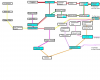
I have attached three images below of my idea for a new tram network in Glasgow. This makes use of mainly existing heavy rail lines converted and disused alignments with very little street running in comparison to the network. This idea more or less dovetails onto my other fantasy idea of Glasgow Crossrail, and is an alternative to a heavy rail solution. I am aware it is one of my fantasies, and will probably remain just that 
1. Convert the present Paisley Canal route and extend along the disused alignment to Port Glasgow via Bridge of Weir. Divert at West Street over the City Union and diverge at St Enoch. Then on-street running to Queen Street station and to Caledonian University (Cowcaddens Road, terminating facing west) via Argyle Street, Queen Street, and North Hanover Street.
2. Clydebank to Robroyston using the former alignment of the Lanarkshire & Dunbartonshire railway to Partick and Exhibition Centre, then along Argyle Street to St Enoch, then join City Union northbound towards Bellgrove (with grade-separated split lines at both ends), continuing along the converted route to Springburn, then on-street to Stobhill Hospital and along Wallacewell Road to Robroyston.
3. Clydebank - Paisley Canal using the former alignment of the Lanarkshire & Dunbartonshire railway to Yoker, then over a new bridge (to replace the Yoker - Renfrew ferry) to Renfrew Cross, Then along Paisley and Renfrew Road to Paisley Gilmour Street station, and on towards Paisley Canal.
4. Airport - Barrhead on street via Love Street to Paisley Canal, where it will join the yellow route to Hawkhead Road, then on street to Dykebar Hospital and onto Barrhead.
5. Barrhead to Caledonian University via Neilston and then using the converted line to Pollokshields East with Williamwood station resited to connect with East Kilbride line, then a new alignment joining onto the City Union just before West Street, then continuing as 1. above to Caledonian University. There would be an interchange at Cathcart (rebuilt) with the Newton route.
6. Paisley Gilmour Street to Robroyston via Renfrew Cross, Southern General Hospital, Govan Cross, Pacific Quay, Exhibition Centre, then continuing as 2. above to Robroyston.
7. Renfrew Cross to Dalmarnock via Braehead Centre, Govan Cross, then 6. above to Bellgrove, then continuing alongside the North British Railway route towards the vicinity of the Duke Street overbridge, diverging off on to street running to Parkhead Forge, along Springfield Road to Dalmarnock.
8. Hamilton Central to Caledonian University via as much as the former alignment to East Kilbride Centre then around the various encroachments of the former trackbed towards East Kilbride old village, where it will join the Glasgow & South Western Railway converted line as far as where it meets the heavy rail line to Kilmarnock, then a new alignment via Pollokshaws West to West Street (possibly alongside a stretch of the existing line and then on street), then as 1. above to Caledonian University. There would be an interchange with the Barrhead via Neilston route at Williamwood.
9. Newton to Caledonian University using the converted line to Pollokshields West via Maxwell Park. Then along a new alignment to just before West Street, then as 1. above to Caledonian University. There would be an interchange at Cathcart (rebuilt) with the Neilston route.
10. Robroyston to Dalmarnock. As 2. above to Alexandra Parade, then reusing (as much of) the former Switchback alignment of the Caledonian Railway to Parkhead Forge, then as 7. above to Dalmarnock.
11. Cumberland Street to Dalmarnock. this route would run direct to Bellgrove avoiding St Enoch. Then onwards to Dalmarnock via as 7. above.
12. Glasgow Central to Queen Street shuttle. This would be on street from Gordon Street entrance, running via Buchanan Street and West George Street, not sharing track with the above central Glasgow routes i.e. a simple self-contained shuttle between the two stations.
My ideas are open for discussion, with friendly comments welcome!
In peace
Adam
1. Convert the present Paisley Canal route and extend along the disused alignment to Port Glasgow via Bridge of Weir. Divert at West Street over the City Union and diverge at St Enoch. Then on-street running to Queen Street station and to Caledonian University (Cowcaddens Road, terminating facing west) via Argyle Street, Queen Street, and North Hanover Street.
2. Clydebank to Robroyston using the former alignment of the Lanarkshire & Dunbartonshire railway to Partick and Exhibition Centre, then along Argyle Street to St Enoch, then join City Union northbound towards Bellgrove (with grade-separated split lines at both ends), continuing along the converted route to Springburn, then on-street to Stobhill Hospital and along Wallacewell Road to Robroyston.
3. Clydebank - Paisley Canal using the former alignment of the Lanarkshire & Dunbartonshire railway to Yoker, then over a new bridge (to replace the Yoker - Renfrew ferry) to Renfrew Cross, Then along Paisley and Renfrew Road to Paisley Gilmour Street station, and on towards Paisley Canal.
4. Airport - Barrhead on street via Love Street to Paisley Canal, where it will join the yellow route to Hawkhead Road, then on street to Dykebar Hospital and onto Barrhead.
5. Barrhead to Caledonian University via Neilston and then using the converted line to Pollokshields East with Williamwood station resited to connect with East Kilbride line, then a new alignment joining onto the City Union just before West Street, then continuing as 1. above to Caledonian University. There would be an interchange at Cathcart (rebuilt) with the Newton route.
6. Paisley Gilmour Street to Robroyston via Renfrew Cross, Southern General Hospital, Govan Cross, Pacific Quay, Exhibition Centre, then continuing as 2. above to Robroyston.
7. Renfrew Cross to Dalmarnock via Braehead Centre, Govan Cross, then 6. above to Bellgrove, then continuing alongside the North British Railway route towards the vicinity of the Duke Street overbridge, diverging off on to street running to Parkhead Forge, along Springfield Road to Dalmarnock.
8. Hamilton Central to Caledonian University via as much as the former alignment to East Kilbride Centre then around the various encroachments of the former trackbed towards East Kilbride old village, where it will join the Glasgow & South Western Railway converted line as far as where it meets the heavy rail line to Kilmarnock, then a new alignment via Pollokshaws West to West Street (possibly alongside a stretch of the existing line and then on street), then as 1. above to Caledonian University. There would be an interchange with the Barrhead via Neilston route at Williamwood.
9. Newton to Caledonian University using the converted line to Pollokshields West via Maxwell Park. Then along a new alignment to just before West Street, then as 1. above to Caledonian University. There would be an interchange at Cathcart (rebuilt) with the Neilston route.
10. Robroyston to Dalmarnock. As 2. above to Alexandra Parade, then reusing (as much of) the former Switchback alignment of the Caledonian Railway to Parkhead Forge, then as 7. above to Dalmarnock.
11. Cumberland Street to Dalmarnock. this route would run direct to Bellgrove avoiding St Enoch. Then onwards to Dalmarnock via as 7. above.
12. Glasgow Central to Queen Street shuttle. This would be on street from Gordon Street entrance, running via Buchanan Street and West George Street, not sharing track with the above central Glasgow routes i.e. a simple self-contained shuttle between the two stations.
My ideas are open for discussion, with friendly comments welcome!
In peace
Adam