No, there's no crossing there any longer. The footpath was diverted many years ago - OpenStreetMap has the diversion from at least 10 years ago. Maybe someone else will know when it happened (e.g. during the WCML Route Modernisation?).
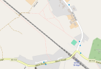
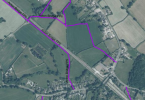
I've attached two images for reference - one from Chester County Council's definitive map, showing the official public rights of way. It shows the FP5 diversion to the nearby bridge in the top left corner of the image. The other image is from OpenStreetMap, which also shows additional other paths in the area (not necessarily designated as rights of way).
In general, footpath information on Ordnance Survey maps are increasingly unreliable. I've been told that they haven't had any kind of comprehensive re-survey in rural areas for many decades. They rely entirely on notifications from local authorities about changed footpaths, not their own surveyors. So if one of those update notifications are overlooked or is otherwise not passed onto the OS, there's no other process to spot the problem at any later point, and the outdated information can sit on their maps indefinitely.