• Our new ticketing site is now live! Using either this or the original site (both powered by TrainSplit) helps support the running of the forum with every ticket purchase! Find out more and ask any questions/give us feedback in this thread!

Major new railways in Europe with construction visible on Google earth/maps?

MPW

Member
Joined
2 Dec 2021
Messages
270
Location
Orpington
Can anyone think of any major new railway projects for which the route can be traced on Google maps?

This is a hobby which I think the people of this forum will actually understand!

HS2 has been very visible for some time now. Some of the Spanish high speed projects are fun to follow on a map, especially the Basque Y with the crazy terrain. However there seems to be a continent wide dry spell of new train lines being built. Outside of Spain the biggest projects I can find are mostly at the intensive tunneling phase (Brenner route, Lyon-Turin, Fehrmann) so there is less to see above ground.
 
Sponsor Post - registered members do not see these adverts; click here to register, or click here to log in
R

RailUK Forums

bluenoxid

Established Member
Joined
9 Feb 2008
Messages
2,668
Sorry, posted this before spotting your last sentence reference to the Fehmarnbelt tunnel project.
 

LNW-GW Joint

Veteran Member
Joined
22 Feb 2011
Messages
21,955
Location
Mold, Clwyd
On Google Maps you can follow about 150km of the route of the new Edirne-Istanbul line as far as Çerkezköy and a bit beyond.
It actually starts just east of Kapikule on the Bulgarian border, with a break through Edirne itself.
This section is due to open soon, and will radically reduce journey times, cutting out the long, slow detour on the old line via Uzunköprü.
The remaining 100km or so section from Çerkezköy on to Halkali west of Istanbul is mostly an upgrade of the existing route and will take longer to complete.
 

MPW

Member
Joined
2 Dec 2021
Messages
270
Location
Orpington
On Google Maps you can follow about 150km of the route of the new Edirne-Istanbul line as far as Çerkezköy and a bit beyond.
It actually starts just east of Kapikule on the Bulgarian border, with a break through Edirne itself.
This section is due to open soon, and will radically reduce journey times, cutting out the long, slow detour on the old line via Uzunköprü.
The remaining 100km or so section from Çerkezköy on to Halkali west of Istanbul is mostly an upgrade of the existing route and will take longer to complete.
Exactly the kind of thing I was hoping for :)
 

Bald Rick

Veteran Member
Joined
28 Sep 2010
Messages
35,978
Not Europe, but you can follow the Califronia High Speed line construction from Merced to Bakersfield
 

Snow1964

Established Member
Joined
7 Oct 2019
Messages
11,297
Location
West Wiltshire
Google maps (satellite view) can see sections of Naples - Bari high speed line (there are lots of tunnels),

The Alicante-Murcia -Almeria line is another one, some sections of trackbed were built a decade ago
 

LNW-GW Joint

Veteran Member
Joined
22 Feb 2011
Messages
21,955
Location
Mold, Clwyd
Another new alignment, though not high speed, is taking shape in Romania between Sighișoara and Brașov, notably the middle section south of Rupea which was winding and slow along the river Olt.
It involves several new tunnels and will shorten the route quite a bit, and be fit for 160km/h.
It's a bit tricky to follow on Google Maps because of the tunnels, but some of the key points are marked as railway construction sites.
I travelled that way in 2017, when similar upgrade work was in progress west of Sighișoara, so once complete there will be a much faster route across Transylvania.
It's also a fascinating region to travel through.
The project “Rehabilitation of the Brașov–Simeria railway line, part of the Rhine–Danube Corridor, for speeds up to 160 km/h – section Brașov–Sighișoara, Subsections: 1. Brașov–Apața and 3. Cața–Sighișoara”, is one of the most ambitious railway infrastructure projects in Romania. It involves a total length of 85 km of double electrified railway, 33 bridges, 93 culverts, 5 viaducts, 4 tunnels, 9 modernized stations, and the implementation of the ERTMS Level 2 European rail traffic management system.
 

SHD

Member
Joined
18 Jul 2012
Messages
572
You can see the construction site of the future Line 18 of the Grand Paris Express between Saclay and Massy, and you can even see the rails of the section aronud Ecole Polytechnique station.
You can also see very well the alignment of the future Picardie-Roissy connector between Saint-Witz and the Vémars triangle, including the new bridge over motorway A 1.
 

Porty

Member
Joined
31 Mar 2020
Messages
279
Location
Edinburgh
Might be worth having a look around the Stuttgart area as there's a huge amount of work going in to build new lines and change the existing terminus station to a through station at 90 degrees to existing tracks. Much of the work is underground but once you're out of the city centre there are new surface lines.

Probably easiest to look firstly at the Wikipedia page for Stuttgart 21 where there's a simple map which picks out the new tunnels and new surface tracks.

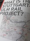
Theres also a decent website (in English), Infoturm Stuttgart should find it. If anyone happens to be passing through Stuttgart it's worth going up the viewing tower in an office block at the southern end of the temporary concourse. Lots to see and read (in German and English) about the station and the wider Stuttgart to Ulm rail project. You can easily spend an hour there. Free publications and maps to take away.
 

Attachments

  • PXL_20260831_120056340.jpg
    PXL_20260831_120056340.jpg
    1.2 MB · Views: 20

MHz_AU

New Member
Joined
3 Oct 2024
Messages
1
Location
Australia
Again not Europe but the formation of the Illabo to Stockingbal NSW section of the (now truncated) Inland Rail route is visible on Google Maps at -34.600987545050025, 147.84758971264168.
 

stuu

Established Member
Joined
2 Sep 2011
Messages
3,774
Brescia-Verona-Vicenza, and various sections between Naples and Foggia are clearly visible
 

Top