• Our new ticketing site is now live! Using either this or the original site (both powered by TrainSplit) helps support the running of the forum with every ticket purchase! Find out more and ask any questions/give us feedback in this thread!

New website with UK rail stations and lines

optional

Member
Joined
30 May 2026
Messages
20
Location
Andover, UK
Hi guys I built this site during my spare time. Hoping some of you will like it.


Happy for feedback, not looking for anything just wanted to share.

I do have permission to post this from the forum moderators.

Kind Regards,
Nathan
 
Last edited:
Sponsor Post - registered members do not see these adverts; click here to register, or click here to log in
R

RailUK Forums

46026

Member
Joined
5 Apr 2015
Messages
58
Location
Devon
Excellent map, nice and clear and easy to use. If you dont mind me saying the search station box would be better if we could put the station name in, cannot see many people knowing a station postcode. I like it though, only looked at a couple of stations in my area and looks all good, well done.
 

optional

Member
Joined
30 May 2026
Messages
20
Location
Andover, UK
That's a really nice, clear map
Thanks :)

== Doublepost prevention - post automatically merged: ==

Excellent map, nice and clear and easy to use. If you dont mind me saying the search station box would be better if we could put the station name in, cannot see many people knowing a station postcode. I like it though, only looked at a couple of stations in my area and looks all good, well done.
Thanks, good idea on the search - I Have integrated that now - you should be able to search by station name e.g. Andover
 
Last edited:

Farigiraf

Member
Joined
23 Jul 2023
Messages
1,140
Location
Bridge on the River Cam
Great map - one thing I noticed was that on many of the named lines, one of the tracks is named 'Unnamed rail line' when you hover over it. Examples being the southbound track on the Cherwell Valley Line and the middle track through Beaulieu Park.
 

flitwickbeds

Member
Joined
19 Apr 2017
Messages
768
Would it be possible to add a toggle to hide the bridge and tunnel sections, so that all rail lines are black?
 

optional

Member
Joined
30 May 2026
Messages
20
Location
Andover, UK
Great map - one thing I noticed was that on many of the named lines, one of the tracks is named 'Unnamed rail line' when you hover over it. Examples being the southbound track on the Cherwell Valley Line and the middle track through Beaulieu Park.
That's a tricky one, I'm looking into it. It looks like it mainly happens with spurs and connecting chords. I might have to redo my data pipeline for the track data a bit to get it to be a bit more obvious if and why some names are missing.
 

pokemonsuper9

Established Member
Joined
20 Dec 2022
Messages
4,586
Location
Greater Manchester
How is a tunnel defined?
By Salford Crescent there is an aggregate plant and the "shed" (for lack of a better word) where material can be dropped out of wagons is listed as a tunnel.
Screenshot of trainmap.co.uk showing Peakstone Private Sidings with a small area shown as a tunnel (orange)
And at Ardwick depot, one of the buildings is counted as a tunnel, but the other isn't.
Screenshot of trainmap.co.uk of Ardwick Depot with one building being treated as a tunnel, and the ther not.
 

D1537

Established Member
Joined
11 Jul 2019
Messages
2,027
Location
North Yorkshire
Looks nice. I wonder if it would be useful to shade the non-NR lines (i.e. preserved railways) a different colour?
 

optional

Member
Joined
30 May 2026
Messages
20
Location
Andover, UK
Would it be possible to add a toggle to hide the bridge and tunnel sections, so that all rail lines are black?
Yes, just updated it, should be live now.

== Doublepost prevention - post automatically merged: ==

How is a tunnel defined?
By Salford Crescent there is an aggregate plant and the "shed" (for lack of a better word) where material can be dropped out of wagons is listed as a tunnel.
View attachment 205065
And at Ardwick depot, one of the buildings is counted as a tunnel, but the other isn't.
View attachment 205067
I think its the way I'm flattening the OSM data into a single "tunnel" boolean for covered sections, I think i have a bit of fine tuning to do. It may be also due to an OSM data limitation, I can neither confirm or deny right this second though.
 
Last edited:

Sir Felix Pole

Established Member
Joined
21 Oct 2012
Messages
2,152
Location
Wilmslow
Excellent work. It is perhaps debatable what constitutes a tunnel - e.g. is Greek Street in Stockport a tunnel (as shown) or an overbridge? As has been pointed out; some depot sheds are being shown as 'tunnels' (e.g. Exeter) but not others (e.g. Plymouth Laira).

The icing on the cake would be to name the principal tunnels and viaducts!
 

sheff1

Established Member
Joined
24 Dec 2009
Messages
6,059
Location
Sheffield
Would it be possible to add a toggle to hide the bridge and tunnel sections, so that all rail lines are black?
I see a toggle - newly added maybe ?

Definitely a clear map, good work.

For a true UK map Northern Ireland needs to be included.
 

optional

Member
Joined
30 May 2026
Messages
20
Location
Andover, UK
I see a toggle - newly added maybe ?

Definitely a clear map, good work.

For a true UK map Northern Ireland needs to be included.
Yes, added the toggle tonight. Also added Northern Ireland.

== Doublepost prevention - post automatically merged: ==

Goodnight all, just before heading off to sleep I have pushed some updates including being able to load in disused and abandoned lines; which I am quite fond of since there is an abandoned line next to where I live.

I've added a changelog so progress on the site can be monitored. https://trainmap.co.uk/changelog.html

Kind Regards
 

Nova1

Member
Joined
26 May 2021
Messages
439
Location
Stratford-Upon-Avon
Nice, but the AI usage is... interesting.

And mapping every single station with coordinates in a single line of HTML code is also questionable.
 

antharro

Member
Joined
20 Dec 2006
Messages
708
The Swanage Railway appears to have one station only; Corfe Castle. The others are missing.
 

MatthewE707

Member
Joined
17 Apr 2025
Messages
154
Location
Essex
Very good map! I wonder if the disused and abandoned lines could be made to stand out a bit more - I'm struggling to see them! They also look very similar to the county boundaries.
 

optional

Member
Joined
30 May 2026
Messages
20
Location
Andover, UK
Nice, but the AI usage is... interesting.

And mapping every single station with coordinates in a single line of HTML code is also questionable.
What AI usage are you referring to? The data isn’t generated using AI. I have added a new page with information about where the data is sourced and what libraries I have used to build the site: https://trainmap.co.uk/attribution.html

I decided to inline the data, so that it loads with the page. Its all static assets at the end of the day, hosted on Amazon S3, I could load the JSON in a separate request, there wouldn't be a huge benefit to doing so.
I just get

This site can’t provide a secure connection​

trainmap.co.uk sent an invalid response.


ERR_SSL_PROTOCOL_ERROR
That's strange. I'm paying Amazon for an SSL certificate so that shouldn't happen. It shows as secure everywhere I have tried it, I'm guessing this must be something on your network side.
 
Last edited:

optional

Member
Joined
30 May 2026
Messages
20
Location
Andover, UK
Yes, my virus chaser recommends not visiting this site.
This may be because its quite new and unknown, I know virus systems like to flag things they don't know about because they can't be sure. If you let me know which virus scanner it is I can maybe see if there is a way for me to send the site URL to them directly so they can learn about it.

If it helps, here is a page with information about which technologies are used on the site: https://trainmap.co.uk/attribution.html
 

rob.rjt

Member
Joined
13 Mar 2010
Messages
102
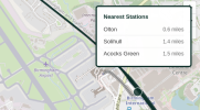
Good map. There is a slight positioning issue with the nearest stations box on desktop - it seems to cover the zoom control
 

Attachments

  • Screenshot from 2026-05-31 07-13-49.png
    Screenshot from 2026-05-31 07-13-49.png
    107.7 KB · Views: 20

Jim the Jim

Member
Joined
18 Dec 2020
Messages
273
Location
Cambridge
Fantastic!

I notice sometimes bridges and tunnels are the "wrong way round", so a bridge appears to go underneath another line (not on a bridge) or a tunnel appears to cross a surface line. Could it be set so that a line on a bridge always appears above other lines, and a line in a tunnel below them?
 
Joined
1 Nov 2021
Messages
305
Location
Berwick
Great map, just tried searching for Heatherslaw in search, although the line is on it doesn't find it in the search
 

optional

Member
Joined
30 May 2026
Messages
20
Location
Andover, UK
Great map, just tried searching for Heatherslaw in search, although the line is on it doesn't find it in the search
Have fixed this :)

== Doublepost prevention - post automatically merged: ==

Good map. There is a slight positioning issue with the nearest stations box on desktop - it seems to cover the zoom control
Have solved this in the latest version by moving the zoom controls to the bottom right position

== Doublepost prevention - post automatically merged: ==

Nice, but the AI usage is... interesting.

And mapping every single station with coordinates in a single line of HTML code is also questionable.
I've done a u-turn on my decision to inline the data, as this may have been one of the candidates for the site to be flagged by antivirus software. I've put all the data into externally loaded assets now.
 

jupiter

Member
Joined
9 May 2021
Messages
332
Location
Dorset
Well done! I love it. You’ll get loads of corrections so I’m reluctant but, you’ve upgraded the branch line to Swanage from heritage to NR.
 

D1537

Established Member
Joined
11 Jul 2019
Messages
2,027
Location
North Yorkshire
Thanks for changing the colour on the non-NR lines - much clearer!

One thing - I'm currently looking at Northallerton station complex and quite a few of the black lines around there appear "broken" at various zoom amounts. I've tried this on a couple of browsers.

ntr2.png
 

Top