• Our new ticketing site is now live! Using either this or the original site (both powered by TrainSplit) helps support the running of the forum with every ticket purchase! Find out more and ask any questions/give us feedback in this thread!

Longest line of sight (UK)

Status
Not open for further replies.

TheHSRailFan

Member
Joined
16 Jun 2018
Messages
297
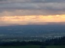
Great stuff from my own backyard!
I bought a Panasonic Lumix ZX 99 to replace my aged ZX 70, although not the main reason for buying, I believe the zoom is at least 30x, how good that is for long distance shots only time will tell, yet to use it for that purpose.

As for the photos above, I'm on my mobile right now so difficult to see in detail, you mentioned Rivington Pike, think it's a "beacon" site so obviously good for long distance views and also being seen!

Meanwhile for those who think Bolton's a grimy Northern town, think all the above were taken inside the borough's boundary and we do have our own volunteer mountain rescue team!
Thank you!
Good call on the camera. I think back in the day Rivington was great for looking out as the signposts mentioned down in the gardens. Back when the air quality was better haha...

It’s not too easy to make out the detail on your picture but regarding the white “tall structure”

I think this may be a mix of 2 structures. The vertical line is possibly a large wind turbine to the west of the A6 near Garstang and the horizontal line behind is I believe the top of one of the reactor buildings at Heysham nuclear power station.

I’d have to draw a line on a map which I can’t do right now to confirm.
Ahh thanks for trying to figure it out, I'll do so cross referening myself when I wake up to be honest.

I have been told it is possible to see the Beetham Tower in Manchester from Snowdonia. The Beetham Tower is no longer the tallest in Manchester and with the skyline rapidly increasing to make Canary Wharf look like a small village I am guessing Manchester city centre will be even easier to spot from miles away.
My photos I've just uploaded is along the way. It's just requires the extremely rare chance that visibility is perfectly clear (which is difficult especially in the North West) which I feel is a lottery at this point.

Some great photos there.....but - if I may make a small observation - the views towards Blackpool, Liverpool and the Irish Sea are looking to the West, not the East. ;)
Haha thanks for noticing, I will admit it was late and I was tired. I was about to shut off my pc when I remembered I needed to check up the forum's and the. Remembering this thread, fixed it now XD.
 
Sponsor Post - registered members do not see these adverts; click here to register, or click here to log in
R

RailUK Forums

Howardh

Established Member
Joined
17 May 2011
Messages
9,794
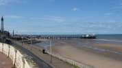
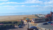
Earlier this week from Blackpool (taken just north of the North Pier) some hazy views of N. Wales coast in the distance, with what looks like the Great Orme poking above the end of the pier!
 

Attachments

  • P1001944.jpg
    P1001944.jpg
    1.7 MB · Views: 99

Trackman

Established Member
Joined
28 Feb 2013
Messages
4,280
Location
Lewisham
Earlier this week from Blackpool (taken just north of the North Pier) some hazy views of N. Wales coast in the distance, with what looks like the Great Orme poking above the end of the pier!
Have you ever been up the Great Orme? Easier to see Blackpool up there!
They have telescopes too, I used one to see the secret messages in the fields that cannot be seen by the naked eye.
 

Howardh

Established Member
Joined
17 May 2011
Messages
9,794
Have you ever been up the Great Orme? Easier to see Blackpool up there!
They have telescopes too, I used one to see the secret messages in the fields that cannot be seen by the naked eye.
Yes, many times, although unaware of secret messages!
 

Bald Rick

Veteran Member
Joined
28 Sep 2010
Messages
35,848
Earlier this week from Blackpool (taken just north of the North Pier) some hazy views of N. Wales coast in the distance, with what looks like the Great Orme poking above the end of the pier!

That’s not unusual. On clear days Snowdonia* stands out very well.

*Yes I know it has a Welsh name, but I don’t speak Welsh.
 

nw1

Established Member
Joined
9 Aug 2013
Messages
9,430
It's a shame the UK doesn't have any isolated 1000m+ mountains in the way some countries do.

I think I've said this before but it's staggering how far you could see from an isolated Ben Nevis-height mountain in the Haslemere area of Surrey, to pick a random "lowland" area I'm familiar with. I've used this site https://www.udeuschle.de/panoramas/makepanoramas.htm

The view from the top would stretch all the way from Blorenge, near Abergavenny, to Mont Lambert, near Boulogne.

And it would also mean presumably that this Surrey version of Ben Nevis would also be visible from both those points. It would look strange, almost ghostly I suspect - an isolated mountain amongst the lowlands.
 

Howardh

Established Member
Joined
17 May 2011
Messages
9,794
It's a shame the UK doesn't have any isolated 1000m+ mountains in the way some countries do.

I think I've said this before but it's staggering how far you could see from an isolated Ben Nevis-height mountain in the Haslemere area of Surrey, to pick a random "lowland" area I'm familiar with. I've used this site https://www.udeuschle.de/panoramas/makepanoramas.htm

The view from the top would stretch all the way from Blorenge, near Abergavenny, to Mont Lambert, near Boulogne.

And it would also mean presumably that this Surrey version of Ben Nevis would also be visible from both those points. It would look strange, almost ghostly I suspect - an isolated mountain amongst the lowlands.

Perhaps we do, maybe not 1000m isolated, but Snaefell on the Isle of Man comes close, thanks to the Irish Sea you can view 5 countries if you're lucky enough to have a clear day - when I went up there I saw about 5 yards!
 

Harvester

Established Member
Joined
9 Nov 2020
Messages
1,767
Location
Notts
...but it doesn't win because the Andromeda Galaxy is visible with the naked eye from a properly dark location ( when it's not cloudy ) and that's about 3 million light years away...
This wins ’by a mile’. The distance is nearer 2.5 million light years, but it can be fairly easily seen with the naked eye if you know exactly where to look in a dark sky.
 

Greetlander

Member
Joined
3 Mar 2018
Messages
230
Location
Sydney, Australia
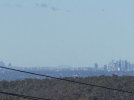
Diving in with an Australian interloper again. Using an iPhone and taken just now from the footbridge at Valley Heights Railway Station in the Blue Mountains. Sydney Harbour Bridge is 60km as the crow flies and 71km by road. I’m fairly sure I’d getter a better shot if I went further up the mountains.
 

Attachments

  • IMG_7429.jpeg
    IMG_7429.jpeg
    1.1 MB · Views: 62

Scotrail314209

Established Member
Joined
1 Feb 2017
Messages
2,475
Location
Edinburgh
Didn’t know where else to post this so hoping someone here can help. Was on a drive along the coast road near Prestonpans on the outskirts of Edinburgh when I looked across at Fife and noticed this weird effect.

Could anyone tell me what sort of effect this is and what causes it?

Both images show a view of Fife from the other side of the River Forth.
 

Greetlander

Member
Joined
3 Mar 2018
Messages
230
Location
Sydney, Australia
Didn’t know where else to post this so hoping someone here can help. Was on a drive along the coast road near Prestonpans on the outskirts of Edinburgh when I looked across at Fife and noticed this weird effect.

Could anyone tell me what sort of effect this is and what causes it?

Both images show a view of Fife from the other side of the River Forth.
Looks like Fata Morgana - are you actually looking at the Scottish coast or is it some far-flung tropical landmass transported by the weather?
 

Scotrail314209

Established Member
Joined
1 Feb 2017
Messages
2,475
Location
Edinburgh
Looks like Fata Morgana - are you actually looking at the Scottish coast or is it some far-flung tropical landmass transported by the weather?
If you can call Fife tropical then sure :p

Cheers - suspected it was a Fata Morgana but figured would get another opinion on it
 

Scotrail314209

Established Member
Joined
1 Feb 2017
Messages
2,475
Location
Edinburgh
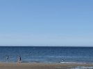
Currently down on Girvan beach, it may take some zooming in but have spotted what I suspect to be the coast of Northern Ireland near Antrim. It’s too far away to be Kintyre and have verified by looking at it on a map.

Photo shows a picture of the sea with the Irish coastline in the distance.
 

Attachments

  • IMG_2498.jpeg
    IMG_2498.jpeg
    1.6 MB · Views: 83

nlogax

Established Member
Joined
29 May 2011
Messages
6,037
Location
Mostly Glasgow-ish. Mostly.
Currently down on Girvan beach, it may take some zooming in but have spotted what I suspect to be the coast of Northern Ireland near Antrim. It’s too far away to be Kintyre and have verified by looking at it on a map.

Photo shows a picture of the sea with the Irish coastline in the distance.
Good spot. Almost every time I've driven down the A77 it's been too hazy to see much beyond Ailsa Craig.
 

adc82140

Established Member
Joined
10 May 2008
Messages
3,410
Not the longest line of sight, but yesterday I'd never seen the English Channel so clear. This is Calais, Cap Griz Nez and across to Boulogne from Dover. Sadly I only had my phone with me, so this is the best I could do, but through the binoculars I could see right across to Dunkerque, and I swear the top of a tower block in De Panne, Belgium.


2025-08-19 105228.jpg
 

Cletus

Established Member
Joined
11 Dec 2010
Messages
2,398
Location
Dover
Not the longest line of sight, but yesterday I'd never seen the English Channel so clear. This is Calais, Cap Griz Nez and across to Boulogne from Dover. Sadly I only had my phone with me, so this is the best I could do, but through the binoculars I could see right across to Dunkerque, and I swear the top of a tower block in De Panne, Belgium.


View attachment 186627

I've always had it in my mind that is the Cap Blanc Nez. The Cap Griz Nez being nearer Boulogne.
 

Cletus

Established Member
Joined
11 Dec 2010
Messages
2,398
Location
Dover
You are quite right. Got my Nez's mixed up.
I think it happens a lot. Cap Gris Nez seems to be the general place name for the nearest point to France, but that's the Grey Nose not the White Nose of the chalk cliffs.
 

Altrincham

Member
Joined
22 Aug 2011
Messages
276
I have been intrigued recently to see how far west you can see from the eastern parts of England. This came about because I’d been visiting the Lincolnshire Wolds. I’d found that there is an area not far from Caistor where there was a clear view to the west and I could clearly make out the Pennine range, and looking at my map I could see that I was looking at the hills of Derbyshire above Sheffield and Chesterfield. Incredibly, within a few short yards along the same road I could see the North Sea on the eastern horizon. (The wind turbines beyond Spurn Point were clearly visible in the late afternoon sun).

The link below shows the road in question (but looking to the coastal view). I’m intrigued to see if there are public footpaths around the nearby NATS radar site that would make it possible to see west and east unhindered from the one spot, as this area is the highest point in Lincolnshire.

https://maps.app.goo.gl/ujyc6bLGfKG2xpmi8

I’d imagine that this is possibly the furthest spot south in eastern England that longer sight lines to the west are possible.
 

mm333

Member
Joined
28 Aug 2008
Messages
776
Location
53.8331°N 1.7734°W
I have been intrigued recently to see how far west you can see from the eastern parts of England. This came about because I’d been visiting the Lincolnshire Wolds. I’d found that there is an area not far from Caistor where there was a clear view to the west and I could clearly make out the Pennine range, and looking at my map I could see that I was looking at the hills of Derbyshire above Sheffield and Chesterfield. Incredibly, within a few short yards along the same road I could see the North Sea on the eastern horizon. (The wind turbines beyond Spurn Point were clearly visible in the late afternoon sun).

I’m intrigued to see if there are public footpaths around the nearby NATS radar site that would make it possible to see west and east unhindered from the one spot, as this area is the highest point in Lincolnshire.

From memory (and I've not been there for 25+ years), the road past the RAF Stenigot ex-radar tower (high in The Wolds between Louth and Wragby) had excellent views west - I'm sure I could see the Trent cooling towers easily - and excellent views east a few hundred yards down the same road towards the coast and south towards Boston Stump. I've not been there on a clear day since the Spurn turbines were built.
 

Cross City

Member
Joined
27 Jan 2020
Messages
935
Location
Birmingham
Spectacularly clear on my drive up the A9 towards Wick this morning.

This is what I think is Ben Rinnes taken from a viewpoint between Brora and Helmsdale, the summit being some 50 miles (80km) away southeast.

1756825450307.jpeg
 

Altrincham

Member
Joined
22 Aug 2011
Messages
276
Yesterday evening I was driving between Altrincham and Buxton, and ascending up the A537 gave some incredible long-distance views to the west. There had been some rain showers drifting over the Cheshire plain and as these were clearing, the views became tremendous. Also helped was the backdrop of sunlight from a very clear horizon.

My photos don’t do it justice, and I hope to stop again on my next trip because part of the way up between Macclesfield and Buxton I also saw a range of mountains to the south west which (according to Viewfinder Panorama and using Shining Tor as my nearest peak) appear to be in Powys, notably Moel Y Golfa. Next time I’ll try and have a better camera plus binoculars with me.

I did take a couple of pictures though when I pulled over at the Cat & Fiddle. The first picture is looking over the top of Macclesfield forest and the glint of sunlight on water in the centre of the picture is the Mersey at its widest point past Frodsham.

I also took another picture looking across to the Cheshire Sandstone Ridge, and in the background is a range of hills in North Wales that I can’t quite pinpoint.
 

Attachments

  • 79F28247-911E-43FE-A321-BCD1E7A3DC7920250903_191746.jpeg
    79F28247-911E-43FE-A321-BCD1E7A3DC7920250903_191746.jpeg
    1.7 MB · Views: 53
  • E03DD56A-0B56-4D79-BE5D-6FC5C9EE2C7A20250903_191821.jpeg
    E03DD56A-0B56-4D79-BE5D-6FC5C9EE2C7A20250903_191821.jpeg
    949.4 KB · Views: 53

Howardh

Established Member
Joined
17 May 2011
Messages
9,794
Just looked at a webcam from St Annes and you can clearly see Snowdonia (could argue easier to see the mountains than the sea at times!!) so looks a very good day for long-distance photography. Might get out later and take some myself.
 

Attachments

  • Opera Snapshot_2025-09-22_120301_www.discoverfylde.co.uk.png
    Opera Snapshot_2025-09-22_120301_www.discoverfylde.co.uk.png
    918.5 KB · Views: 53

DelW

Established Member
Joined
15 Jan 2015
Messages
6,014
From the track just behind West Blockhouse, south of Dale in Pembrokeshire, what looked like an island was visible on the horizon to the southeast, and to the right of Linney Head. Checking the bearing, it must have been Lundy, which per Google maps, is between 40 and 42 miles distant. Unfortunately it wouldn't have looked impressive in a photograph.
 

Bald Rick

Veteran Member
Joined
28 Sep 2010
Messages
35,848
From the track just behind West Blockhouse, south of Dale in Pembrokeshire, what looked like an island was visible on the horizon to the southeast, and to the right of Linney Head. Checking the bearing, it must have been Lundy, which per Google maps, is between 40 and 42 miles distant. Unfortunately it wouldn't have looked impressive in a photograph.

Lundy is often viewable from there. I‘ve seen a number of times from St Govans Head (about 9km nearer Lundy) when it was so clear it seemed close enough to swim to. Also from St Govans Head on a clear day you can see the hills around Hartland Point and over to Exmoor - thats 50-60 miles.
 

DelW

Established Member
Joined
15 Jan 2015
Messages
6,014
Lundy is often viewable from there. I‘ve seen a number of times from St Govans Head (about 9km nearer Lundy) when it was so clear it seemed close enough to swim to. Also from St Govans Head on a clear day you can see the hills around Hartland Point and over to Exmoor - thats 50-60 miles.
Google gives St Govans Head to Hartland at about 44 miles, and to Morte Point at about 42, so fairly comparable with WB to Lundy. St Govans to Exmoor would indeed be at least 55 miles though.

I'm in the Dale area for a few days, so I'll see if I can see any sign of north Devon at 53 - 54 miles. I suspect I might need greater elevation than the St Ann's peninsula offers though.
 

Bald Rick

Veteran Member
Joined
28 Sep 2010
Messages
35,848
Google gives St Govans Head to Hartland at about 44 miles, and to Morte Point at about 42, so fairly comparable with WB to Lundy. St Govans to Exmoor would indeed be at least 55 miles though.

I'm in the Dale area for a few days, so I'll see if I can see any sign of north Devon at 53 - 54 miles. I suspect I might need greater elevation than the St Ann's peninsula offers though.

Although closer to N Devon, the Ridgeway between Lamphey and Tenby is a good vantage point; 110m AMSL at its highest point just above Manorbier station.
 

Greetlander

Member
Joined
3 Mar 2018
Messages
230
Location
Sydney, Australia
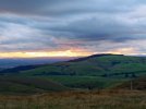
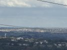
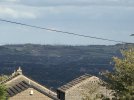
So I'm back in the old country and I'm off up Boulsworth Hill tomorrow to stare in the general direction of Blackpool. However today I was up at Bolster Moor (top of the Colne Valley overlooking SW Huddersfield) and noticed windfarms and then a power station in the far distance. So - what was I looking at and how far away is it.
 

Attachments

  • Boulsworth1.jpeg
    Boulsworth1.jpeg
    1,000.9 KB · Views: 52
  • boulsworth3.jpeg
    boulsworth3.jpeg
    1.5 MB · Views: 52
  • boulsworth2.jpeg
    boulsworth2.jpeg
    677.3 KB · Views: 52
Status
Not open for further replies.

Top